
With support from the Australian Space Agency, Advanced Navigation has developed Boreas X90, an inertial navigation system to autonomously explore the Moon and beyond to Mars, to help uncover scientific discoveries, unlock the lunar economy and inspire a new generation of space explorers.
Tag: INS
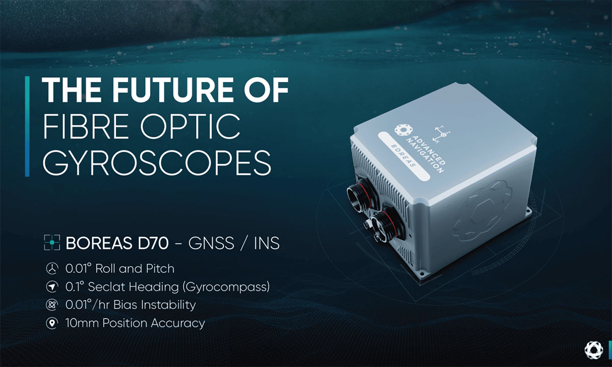
Advanced Navigation Announces Boreas D70, New Digital Fibre-Optic Gyroscope
Global, October 2022 – Advanced Navigation, the world’s most determined innovator in artificial intelligence for robotic and navigation technologies is announcing Boreas D70, a fibre-optic gyroscope (FOG) inertial navigation system (INS).
18 October 2022
Go to Article
Benefits of Using Post-Processing Kinematic (PPK) Software in GNSS Based and Inertial Navigation Solutions
Kinematics is the study purely of the motion of objects, without concern for the forces involved causing the motion. In a navigational sense, kinematics is a bit different to the definition above. We are still wanting to gain motion information for a moving object, but the context here is to establish the true path (or as close to the truth as we can get) of the object in relation to an absolute position on the surface of the Earth.
17 October 2022
Go to Article
Acoustic Positioning and Navigation – An Introduction
Acoustic signaling is a method of using sound as a means of wireless underwater communications. Acoustics are used because radio waves, light waves and satellite signals cannot travel through water for any useful distance because of signal attenuation (reduction in amplitude) due to water density.
8 September 2022
Go to Article
The Future of Inertial Navigation is Classical-Quantum Sensor Fusion
Inertial navigation using quantum sensor technology is a new field of research and development that can completely revolutionize navigation systems. This novel technology increases inertial measurement accuracy by orders of magnitude over current benchmarks. This can enable absolutely reliable inertial navigation systems (INS) that can operate entirely standalone and retain accuracy over the course of years rather than months using current technology.
25 August 2022
Go to Article
Dead Reckoning for GNSS Denied Scenarios – An Introduction
Dead-reckoning is a term coined in the 1600s by ship navigators to estimate course and distance when no landmarks or stars could be seen. Using velocity, a compass and the directional effects of current and wind, ship navigators could plot or estimate a course with a reasonable degree of accuracy for the time, especially over short distances.
17 August 2022
Go to Article
Certus MEMS INS Improves Efficiency of LimnTech Scientific Road-Marking Solution
LimnTech Scientific use Certus MEMS INS to greatly improve penetration into GNSS impaired areas for automated road marking.
19 July 2022
Go to Article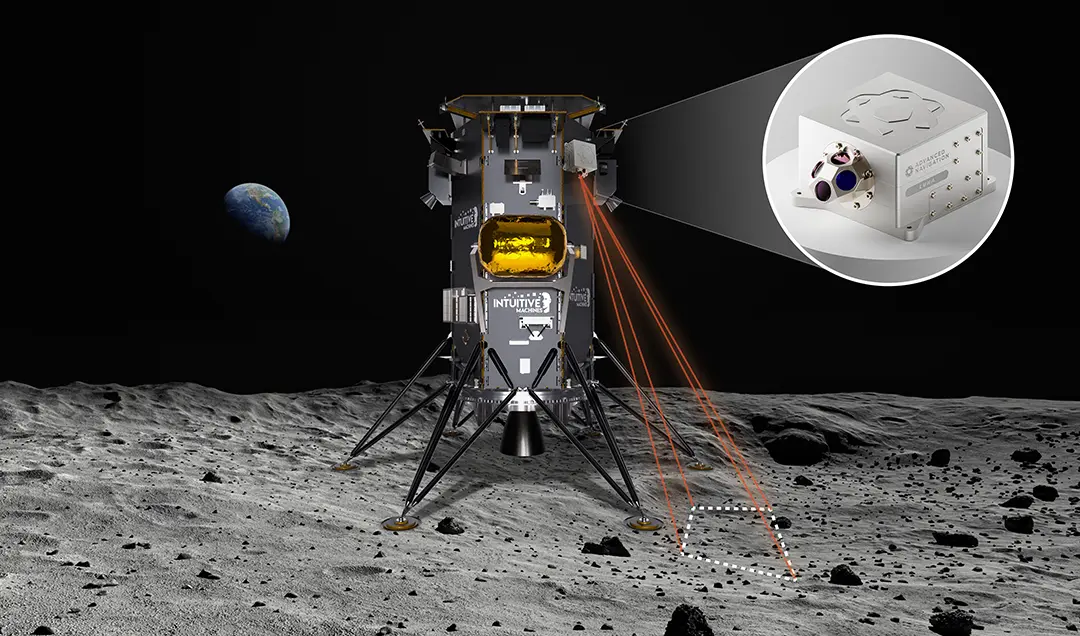
Advanced Navigation Set To Be The First Australian Company To Reach The Moon
Australia, July 2022 – Advanced Navigation, one of the world’s most determined innovators in AI robotics, and navigation technology has today announced its ambitions to be the first Australian company to reach the Moon through its development of two unique navigation systems.
15 July 2022
Go to Article
INS Evolution Helps EyeVi Technologies Achieve Scalable LiDAR Survey Efficiency for Road Networks
EyeVi Technologies uses Certus Evo to streamline road maintenance through their scalable LiDAR road surveying solution.
28 March 2022
Go to Article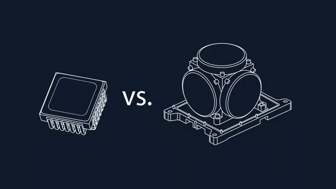
MEMS VS FOG: What Inertial System Should You Choose?
MEMS vs FOG: the Ring laser gyroscope (RLG) has dominated the inertial navigation market since its first inception in 1963, recently its dominance has been challenged by improvements to Fibre Optic Gyroscope (FOG) technology. These technological improvements are slowly but surely eroding the RLG’s place in the inertial navigation market, pushing the aging technology to irrelevance.
10 February 2022
Go to Article