
Dead Reckoning for GNSS Denied Scenarios – An Introduction
Share:
Published on:
Dead-reckoning is a term coined in the 1600s by ship navigators to estimate course and distance when no landmarks or stars could be seen. The history behind the term dead-reckoning reputes that a log or other floating object would be thrown overboard at the bow of the ship and observed as the ship passed it by to estimate velocity (speed). Using velocity, a compass and the directional effects of current and wind, ship navigators could plot or estimate a course with a reasonable degree of accuracy for the time, especially over short distances.

Traditional maritime navigators used a variety of tools and techniques to traverse the high seas
Imagine exploring a cave system, slowly heading through it by map and torchlight. You make turns and move forward then enter different tunnels and so on. Suddenly, your torch batteries decide to die and you are left in total darkness without any navigation aids or devices. You might immediately panic and start shouting for help, but the echoes only serve to heighten your panicked state. Or, you remember where you were on the map when the light went out – your last known position; then attempt to retrace your steps by estimating your position. You go back to what you estimate to be your previous straight line direction and distance, then turn in the reverse direction where you think you last turned and by the same amount and travel an estimated distance and so on. Effectively, you are dead-reckoning. Hopefully you remember your initial route well and your estimates of distance by steps and orientation are accurate until you see the glimmering savior of light. Better still, your torch batteries decide to rescue you.
Interestingly, there are a great many creatures of land, air and sea that can innately dead-reckon with incredible accuracy. Many of them rely on dead-reckoning to quickly and reliably return to a safe haven in the face of danger. Survival often depends on it. Humans, on the other hand, are not particularly adept at dead-reckoning. So we invent things that can help us do it.
We will use the animation below to illustrate a dead-reckoning being applied to a vehicle using an inertial navigation system (INS). Watch the entire animation. To keep things simple, the vehicle is able to rotate on its Z-axis. The blue variant shows the perfect trajectory. That is, where we actually want to go by distance, time and heading. The vehicle accelerates from standstill (zero velocity) and back to zero over a period between each change of direction.
The red vehicle is an attempt to follow the trajectory of the blue vehicle using dead-reckoning by an INS (Inertial Navigation System) only. That is, the INS accelerometers and gyroscopes are estimating linear acceleration and rate of rotation, with an internal timing clock reference. As you can see, there are discrepancies between the two trajectories due to limitations in sensor accuracy and a tendency for sensors to drift. Note that inaccuracy and drift is exaggerated for illustrative purposes.
The trajectory for the blue vehicle is:
- Move straight ahead from (A) 7.5 m to (B) in 3 s.
- Rotate 45° counterclockwise, move straight ahead from (B) 22.5 m to (C) in 5 s.
- Rotate 135° clockwise, move straight ahead from (C) 42.5 m to (D) in 9.5 s.
- Rotate 30° clockwise, move straight ahead from (D) 15.8 m to (E) in 5 s.
At the end of the journey, the blue vehicle should have travelled 88.3 m over 22.5 s (not including time required for rotation). The red vehicle is close to the blue vehicle, however, some distance away in terms of position and heading.
Global Navigation Satellite System (GNSS) and Dead-Reckoning Today
On-earth navigation, with the exception of underwater applications, typically rely on global navigation satellite systems (GNSS) to provide a reliably accurate position for location. Note that “GPS”, which is probably the most well known satellite constellation, was the first such satellite positioning system to be developed and deployed. The GPS constellation is operated by the United States. Timing signals from satellites in GNSS constellations are constantly emitted towards the Earth. Part of the signal includes the exact time that the signal was sent.
GNSS receivers (any smartphone has one) require a minimum of 4 observable satellites to determine position to approximately 5 m accuracy. The GNSS receiver calculates its position based on the time each observable satellite signal was sent and received as well as the position of the observed satellite. With the aid of ground base stations providing correction information for satellite signals, high performance antennas and processors, and point-to-point geometry processing (kinematics), this accuracy can be improved to <1 cm (<½”).

There are several GNSS satellite constellations orbiting the Earth. Each providing data for positioning across various continental areas
GNSS is great until your equipment can no longer “see” enough satellites to provide position. What causes degraded GNSS reception or non-availability of GNSS?
- Underground and tunnels
- Areas with tall buildings
- Ravines, canyons and valleys
- Areas of insufficient GNSS coverage
- Amongst dense vegetation
- Jammed or compromised/spoofed GNSS signals
- Failure of GNSS reception equipment
This is when dead-reckoning is required to maintain movement tracking until such time as a GNSS fix is attained. Dead-reckoning today, using modern equipment, is a far cry from its humble roots. Sure, many of the skills of compass, charts, rules and protractors are increasingly lost to technology, but this has also made dead-reckoning a technology that we can rely on when, figuratively speaking, the satellites go out.

Illustration depicting some scenarios that may impair or deny GNSS signal reception. (A) Tall buildings and urban canyons; (B) dense and tall vegetation; (C) underground mines and tunnels; (D) canyons, gorges and mountainous terrain; (E) indoor and undercover use; (F) underwater
The need for dead-reckoning in the modern age has stemmed largely from the needs of military forces across the world due to location and the need to be less prone to GNSS signal jamming and manipulation (spoofing). The market for dead-reckoning equipment, however, is broadening in the commercial and civilian sectors, particularly in surveying, as necessary for “filling in the gaps” between GNSS fixes as well as for redundancy applications. Examples include:
- Aerial and ground vehicle navigation
- Robotics
- Building-bound/interior automated vehicles and robots
- Mining and underground
- Scientific and environmental research
Enter the inertial navigation system (INS). INS applies the principle of dead-reckoning to estimate position when GNSS positioning information is unavailable. It can also be used in conjunction with active GNSS to assist in improving position accuracy by providing a secondary source for input data that can be used in position computations. As an example, Advanced Navigation inertial navigation systems constantly fuse INS and GNSS data as part of a sophisticated AI-based method of internal verification. Using GNSS as a source of reference, the INS is able to “learn” sensor drift and other errors that it can then apply to inertial calculation when performing actual dead-reckoning.
There are several major technologies that are popular in inertial navigation systems. Each type has a bearing on how accurate the system is, how robust it is against shock, vibration, noise and interference, how much it costs, how bulky or heavy it is and so on. These factors basically determine its end use.
Recent Tech Articles
How Improved Positional Accuracy Can Transform Mining Excavation
Explore the new standard in absolute positioning for GNSS-denied environments. See how the Chimera Land LVS and INS pairing anchors real machine motion.
15 June 2026
Go to Article
High-Precision Navigation at Scale for Counter Drone Technology
Unlock precision for your kinetic effector on-the-move. Discover how Advanced Navigation delivers the stabilization and supply chain speed needed for scalable counter drone defense.
18 May 2026
Go to Article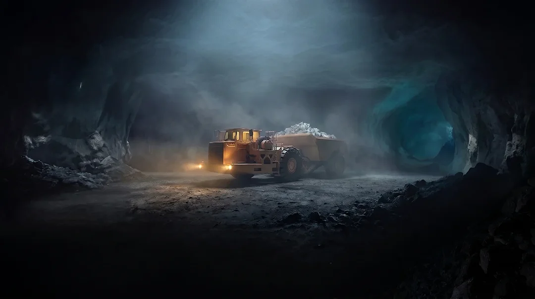
Navigating the Future of Mining Operations
Discover how to improve product quality in manufacturing through Advanced Navigation's rigorous supply chain and exhaustive validation.
5 May 2026
Go to Article