Marine Navigation
Marine Navigation Systems
Advanced Navigation equipment is widely deployed in marine navigation applications. The company continues to invest in research and development to provide ever improving solutions for dealing with this harsh environment. Marine applications require equipment that can withstand strenuous conditions as well as help clients deliver improvements in efficiency, safety and smaller carbon footprint – we understand that these are increasingly important considerations. We also understand the need for designing and building tools and navigation systems for marine users that will provide not only be commercially beneficial, but will assist in improving our interaction with the marine environment. Our clients cover a vast array of applications, ranging from vessel navigation, hydrography, research, and inspection of critical infrastructure to competitive yacht navigation.
Advanced Navigation seeks to not only assist you in navigating exactly where you want your vessels or assets to be in the water, but to leverage our expertise in precision robotics, navigation and artificial intelligence to create new horizons that will mutually benefit human effort and sustainable interaction with marine habitats and lifeforms.
Advanced Navigation has long understood the benefits of artificial intelligence and machine learning using artificial neural networks, not only in its areas of expertise, but the widespread adoption of this technology to create better, more responsive, responsible, and sustainable products.
Trusted by the world’s most innovative companies
Technologies
Inertial Navigation Systems for Marine Navigation
Advanced Navigation has a range of MEMS and fibre-optic gyroscope (FOG) based inertial navigation systems (INS) covering a range of performance grades that make them suitable for various maritime applications, including navigating crewed vessels and autonomous uncrewed surface vessels (USV) and hydrographic survey.
Boreas DFOG products feature gyroscompassing capability that enable them to rapidly establish heading even in conditions of high dynamic motion, such as heave and listing, without requiring GNSS or magnetometers. The reliability of data from the Boreas system provides very high levels of confidence in determining a relative or absolute position of a vehicle or vessel. Additionally, Boreas is much less affected by sources of magnetic interference, which are common to marine surface vessels.
Advanced Navigation products are extremely compact and light for easier integration.
All Advanced Navigation products that support GNSS aided navigation, the systems come standard with multi-frequency and multi-constellation support for RTK to meet the most demanding requirements.
Satellite Compass
The GNSS Compass is a robust, proven solution that is widely used in marine applications for vessel navigation and for underwater USBL acoustic navigation systems. The dual antenna array provides high-accuracy position, roll, pitch and heading and, with INS capability, is an ideal navigation tool for watercraft of all types. The GNSS Compass seamlessly integrates with our INS solutions and Subsonus USBL to transfer absolute position, heading and motion information to the underwater environment for precision tracking and navigation of underwater assets such as ROVs and AUVs.
Applications of Marine Navigation Systems
Our innovations are bringing new levels of operability, performance and versatility that are assisting our marine and subsea clients achieve objects more effectively and efficiently than ever before.
Vessel Navigation Systems
Marine navigation systems are becoming increasingly sophisticated as technology for sea applications improves. This means more accurate heading and position that can integrate GNSS for absolute position, and north seeking fibre-optic gyro-compassing for non-magnetic heading.
Simple integration is increasingly important, as is SWaP-C, and the ability for navigational devices to be adopted across varying vessel types and applications. Advanced Navigation products feature a common API to enable them to be readily integrated and communicate with your other systems, such as visual data capture and vehicle control modules. Because the messaging protocol is standard across products, you can change the performance grade of the navigation system without additional engineering.
Knowing exactly where you are as a surface vessel is paramount to safe and efficient sailing, with Advanced Navigation products covering the spectrum of marine navigation applications.
Yacht Racing
Competitive yacht racing, such as the America’s Cup, attracts cutting edge sailing technology as much as it does sponsorships and endorsements. As yachting relies on the elements, the boat and how well the crew set sail and navigate, teams must look to find and extract the tiniest of advantages over their adversaries in a very closely competitive sport. To gain advantage includes gaining a thorough understanding of yacht dynamics in all manner of conditions.
Using data from a high-accuracy INS with a high update rate mounted in the yacht and data from other vessel systems gives team managers and technicians the ability to very thoroughly analyze boating performance. Using a GNSS MEMS INS provides substantial data for list, velocity, heave, pitch and heading that can be used both in real-time but in analysis when testing new equipment, such as keels and sails.
Support vessels, such as high-speed foils, to the racing yachts are often fitted with a high grade MEMS GNSS INS. Accurate and reliable navigation, even in heavy swells, helps support crews rapidly and accurately reach the yacht in the event of an emergency or other need.
Surveying, Hydrography & Bathymetry
Detailed seabed maps are vital to laying of telecommunications infrastructure that connect different regions of the world and the installation of ocean based energy stations and rigs. Knowing the contour and makeup of the seabed strata is critical to safe and reliable cabling, pipelines, footings and moorings. Not only by mapping its shape but also gaining understanding of how the seabed changes over time and how it affects oceans, lifeforms and habitats, even climate. The Seabed 2030 project is testament to this need, aiming to amalgamate all available bathymetric data to produce a definitive map of the world’s ocean floor by 2030.
Hydrography and bathymetry solutions typically use a host of differing technologies to achieve the required results. Much of this is to do where the survey is being performed, depth of water and if the survey can be carried out from a surface vessel using towfish or similar sensor package. Accurate georeferencing of the seabed to absolute position is critical in any surveying application, however, due to underwater being fully denied of GNSS signals and the use of magnetic heading often difficult, different navigation technologies may be required, such as Boreas DFOG and high performance Subsonus USBL systems.
Offshore Wind Turbine Energy
The renewable energy sector and markets are increasing in importance to the point where they are competing with fossil fuels in some regions. Wind turbines are popular in marine based energy generation applications due to the almost constant wind that is available.
Wind farms are typically large scale, with many wind turbines spread out across expanses of ocean. Precision placement of turbines is important to maximizing energy yield, as is controlling the “heading” of rotatable turbines to best make use of prevailing conditions. GNSS Compass is an ideal tool for gaining accurate wind turbine heading data that can be used for optimizing energy generation.
Recommended Solutions
Certus
Market-leading dual antenna INS
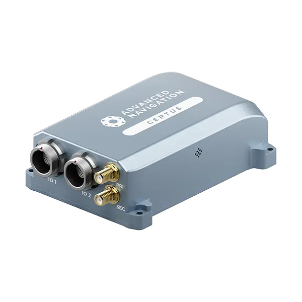
Roll & Pitch
0.1 °
Heading (GNSS)
0.1 °
Bias Instability
3 °/hr
Position Accuracy
10 mm
Full Specifications
Certus Evo
Ultra-high accuracy MEMS INS
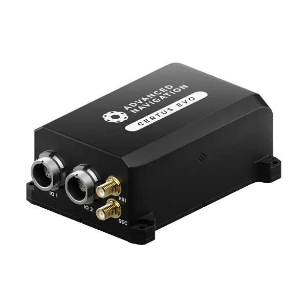
Roll & Pitch
0.03 °
Heading (GNSS)
0.05 °
Bias Instability
0.2 °/hr
Position Accuracy
10 mm
Full Specifications
GNSS Compass
Plug-and-play GNSS/INS
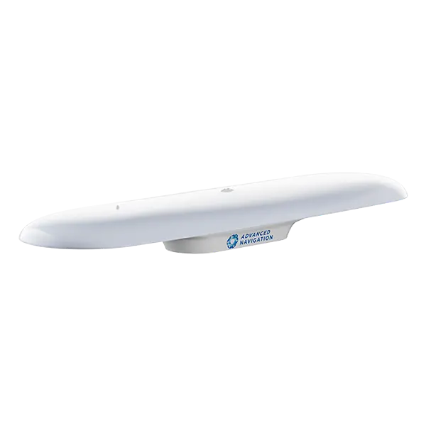
Roll & Pitch
0.4 °
Position Accuracy (RTK)
0.01 m
Heading
0.2 °
Update Rate
200 Hz
Full Specifications
Boreas D70 & D90
World-first digital FOG technology
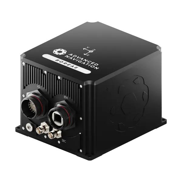
D70
D90
Roll & Pitch
0.01 °
0.005 °
Heading
0.1 ° seclat
0.01 ° seclat
Bias Instability
0.01 °/hr
0.001 °/hr
Position Accuracy
10 mm
10 mm
Full Specifications
Accurate Positioning in the Most Demanding Conditions
High Performance
Our systems deliver the highest performance and richest feature set on the market. Our high-performance navigational systems are designed to industry standards, ensuring reliability and efficiency across diverse applications.
Trusted Reliability
All our systems are designed and tested to safety standards with fault tolerance built in to provide you with the highest reliability possible. Our reliability is trusted by many of the world’s largest companies.
Quality
Our systems are built to the highest quality standards in Australia to endure the test of time in the most difficult conditions. You can rely on our products.
The Latest News in Marine Navigation

Europe Expansion with High-Profile Military Appointment
16 June 2026
Go to Article
Advanced Navigation Secures US$110M Series C to Catalyze the Next Era of Autonomous Systems
17 March 2026
Go to Article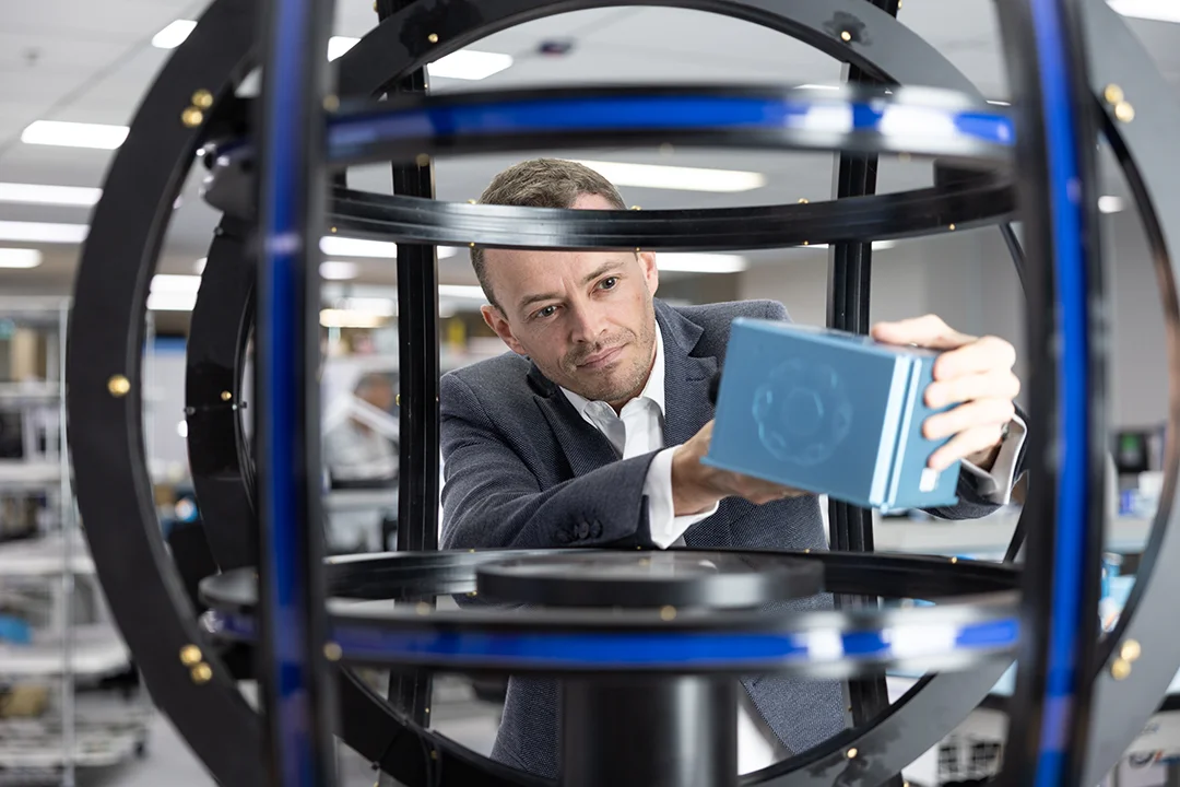
Advanced Navigation Appoints Chief Technology Officer to Drive Breakthroughs in Deep-Tech Autonomy
1 February 2026
Go to Article
Micro Hovering AUV, Hydrus, Exposes Coral Loss at One of the World’s Southernmost Reefs
3 June 2025
Go to Article
Welcoming Head of Product to Dominate Innovation Across Navigation and Autonomy
16 February 2025
Go to Article
Unleashing Precision: Advanced Navigation Fuels Orient Express In the High-Stakes America’s Cup
22 August 2024
Go to ArticleCommon Questions about Marine Navigation Applications
What are the current challenges facing commercial marine operators?
Increasing pressure from multiple sectors in response to climate change and increased conservation is significantly altering human interaction with the oceans. There are major pushes towards reducing vessel size and crew numbers and accelerating operations so that off-shore time is minimized. This is being driven by not only third-party clients of marine navigation services but operators themselves to reduce costs and carbon emissions.
Emerging technologies for autonomous water-based vehicles are driving a new approach to off-shore surveys, inspection and data collection. Small scale electrically powered USVs are delivering large reductions in vessel costs and traditional diesel engine emissions through rapid deployment, superior mobility and speed. The adoption of complex AI and high-performance navigation systems and other sensing technologies in conjunction with these vehicles is providing greater scope for marine operations without the previous massive capital expenditure, required skill sets and logistics.
How is artificial intelligence used in marine navigation systems?
Advanced Navigation has long advocated the use of artificial intelligence and deep learning artificial neural networks. This technology is a feature that enables marine navigation systems, for example, to use previous data to identify and compensate for sensor drift, causing accuracy to improve, over time. Continued refinement and adoption of AI bring benefits in automated systems and robotics. Using AI to interconnect sensor suites and vehicle subsystems enables superior control and the ability for the vehicle to react to its surroundings without human intervention. For example, collision avoidance and performing actions based on recognition of an object of type.
AI is well suited to fusing asynchronous data from different sensors and using this data to make cohesive estimates of position and motion. That is, integrating and fusing data that arrive at different times from sensors that update at different speeds; for example, 1000 Hz, 1 Hz, or in the case of USBL, varying speed depending on acoustic travel time.
What are some of the benefits of adopting autonomous marine navigation systems?
The benefits of autonomous and uncrewed water vehicles are vast. Autonomous vehicles require no equipment for human operators, which allows them to be incredibly compact and designed specifically for the intended tasks. Smaller, lighter equipment with reduced complexity is easier to manufacture, uses fewer resources and is more affordable to operate and maintain.
Autonomous and semi-autonomous vehicles are not only reducing capital expenditure in maritime services but revolutionizing it. For instance, future robotic vehicles in the offshore field that can autonomously make informed decisions. The effects are noticeable drops in carbon emissions, significant improvements in efficiency, and reduced time-to-mission. These heavily reduce costs for crew, vessels and ancillaries, and provide the ability to more frequently carry out survey and data acquisition missions.