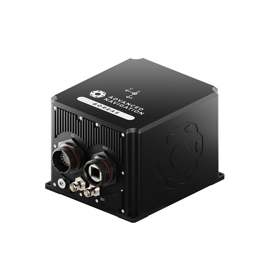
Boreas D70 & D90
The Boreas D70 and D90 Series is a rugged inertial navigation system with a north-seeking gyrocompass that maintains reliable navigation in GPS-denied and harsh environments and a lower SWaP-C (Size, Weight, Power and Cost).
D70
D90
Roll & Pitch
0.01 °
0.005 °
Heading
0.1 ° seclat
0.01 ° seclat
Bias Instability
0.01 °/hr
0.001 °/hr
Position Accuracy
10 mm
10 mm
The Boreas D Series provides north-seeking gyrocompassing for accurate heading and orientation, even in GNSS-denied environments. The D70-X20P & D90-X20P add an all-band GNSS receiver. The D70-MX5 & D90-MX5 add a multi-band GNSS receiver. The D70-MX5 & D90-MX5 are electronic protection variants that add resilience against GNSS jamming and spoofing.
Features
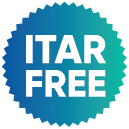
FOG Technology
The Boreas fiber optic gyroscope (FOG) is a highly accurate and reliable navigation technology. It’s the result of over 25 years of development in partnership with two research institutions. The gyroscope uses a closed-loop optical coil and an advanced spread-spectrum digital modulation technique to improve accuracy, stability, and reliability while reducing size, weight, power, and cost.

Gyrocompass North-Seeking
The Boreas range of FOGs can determine heading without needing a Global Navigation Satellite System (GNSS) or a magnetometer. By sensing the Earth’s rotation, the system’s north-seeking algorithm can acquire an accurate heading. This is possible in static and dynamic conditions, even at high latitudes.

Reliability
Boreas D70 & D90 has been designed from the ground up for rugged reliability. Both the hardware and software are tested and certified to environmental and electromagnetic standards (MIL-STD 461 and MIL-STD 810H). The precision aluminum enclosure is waterproof and dustproof to the IP67 standard. The system is resilient to shock and vibration, allowing it to be used in extreme conditions.

Industry-Leading SWaP-C
The Boreas FOG Series delivers industry-leading performance with a lightweight design, excelling in terms of Size, Weight, Power, and Cost (SWaP-C).

Multi Protocol Support
The Boreas features multiple interfaces, including Ethernet, CAN, RS232, 1PPS, RS422, and GPIOs. It supports industry standard protocols, including NMEA 0183, CANopen, 1PPS, and ANPP, as well as a wide variety of proprietary protocols. A rich, responsive embedded web interface provides full access to all of the device’s internal functions and data. Internal storage allows for up to one year of data logging.
Applications
Marine Surveying
Land Surveying
Antenna Targeting
ROV/AUV Navigation
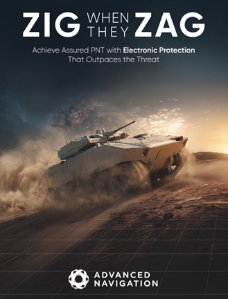
Is Your Navigation Stack Compromised?
Everything can be jammed. Everything can be spoofed. Find out how to achieve assured PNT with Electronic Protection that outpaces the threat.
Download the report
Specifications
Navigation
Sensors
Accelerometers
Gyroscopes
Pressure
GNSS
Supported Navigation Systems
Supported SBAS Systems
Max Update Rate
Signal Re-aquisition First Fix
Cold Start First Fix
Horizontal Position Accuracy
Horizontal Position Accuracy (with SBAS)
Horizontal Position Accuracy (with RTK)
Velocity Accuracy
Timing Accuracy
Acceleration Limit
Reference Inputs
Communication
Hardware
Downloads
Datasheet D90
Datasheet D70
3D Model
Boreas D90 Performance Evaluation
INS Manager – Desktop
Version 8.1
26 Jun 2026
INS Manager – Deskop is used for testing, configuration, firmware management and logging with Advanced Navigation’s INS devices. Java 11 is required to run INS Manager – Desktop. Adoptium JRE 11 is the recommended Java installer. Refer to respective INS Manuals for the user guide.
Boreas D70 Firmware
Version 2.11
30 Jun 2026
Firmware for Boreas D70 hardware versions. This can be loaded onto Boreas using the web interface or the Boreas Manager software. The change log can be found in the Boreas reference manual.
Boreas D90 Firmware
Version 2.11
30 Jun 2026
Firmware for Boreas D90 hardware versions. This can be loaded onto Boreas using the web interface or the Boreas Manager software. The change log can be found in the Boreas reference manual.
Boreas SDK
Version 7.3
28 Aug 2024
The Boreas SDK provides example source code for interfacing with Boreas through the AN Packet Protocol. The languages provided are C/C++, Java, and .Net C#.
Related Articles
Hanwha Selects Advanced Navigation in $8.7 Million Deal for GNSS-Degraded Navigation
23 September 2024
View Post
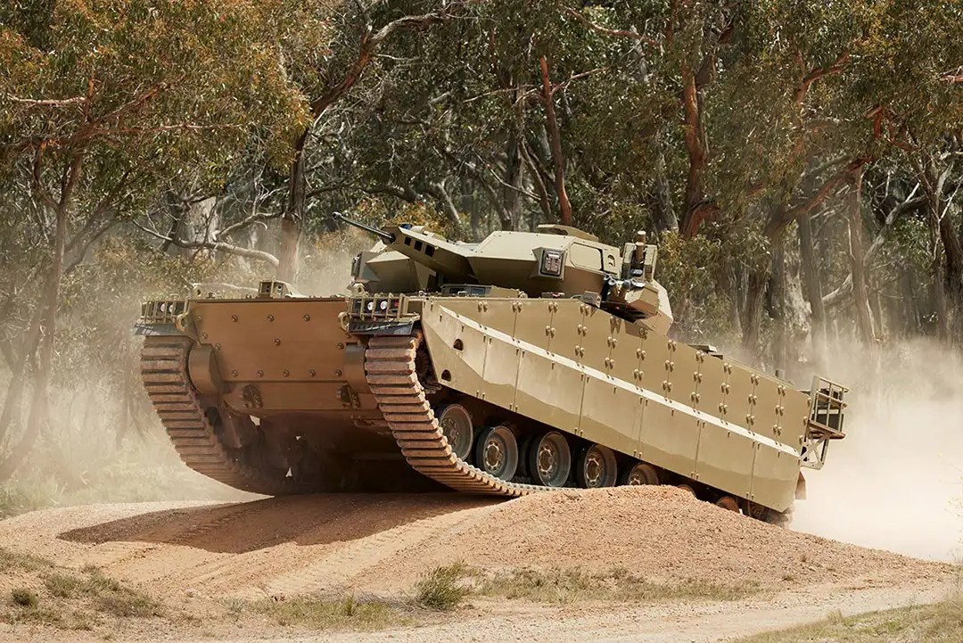
Inertial Navigation: Empowering Armored Combat Vehicles in GNSS-Denied Environments
3 September 2024
View Post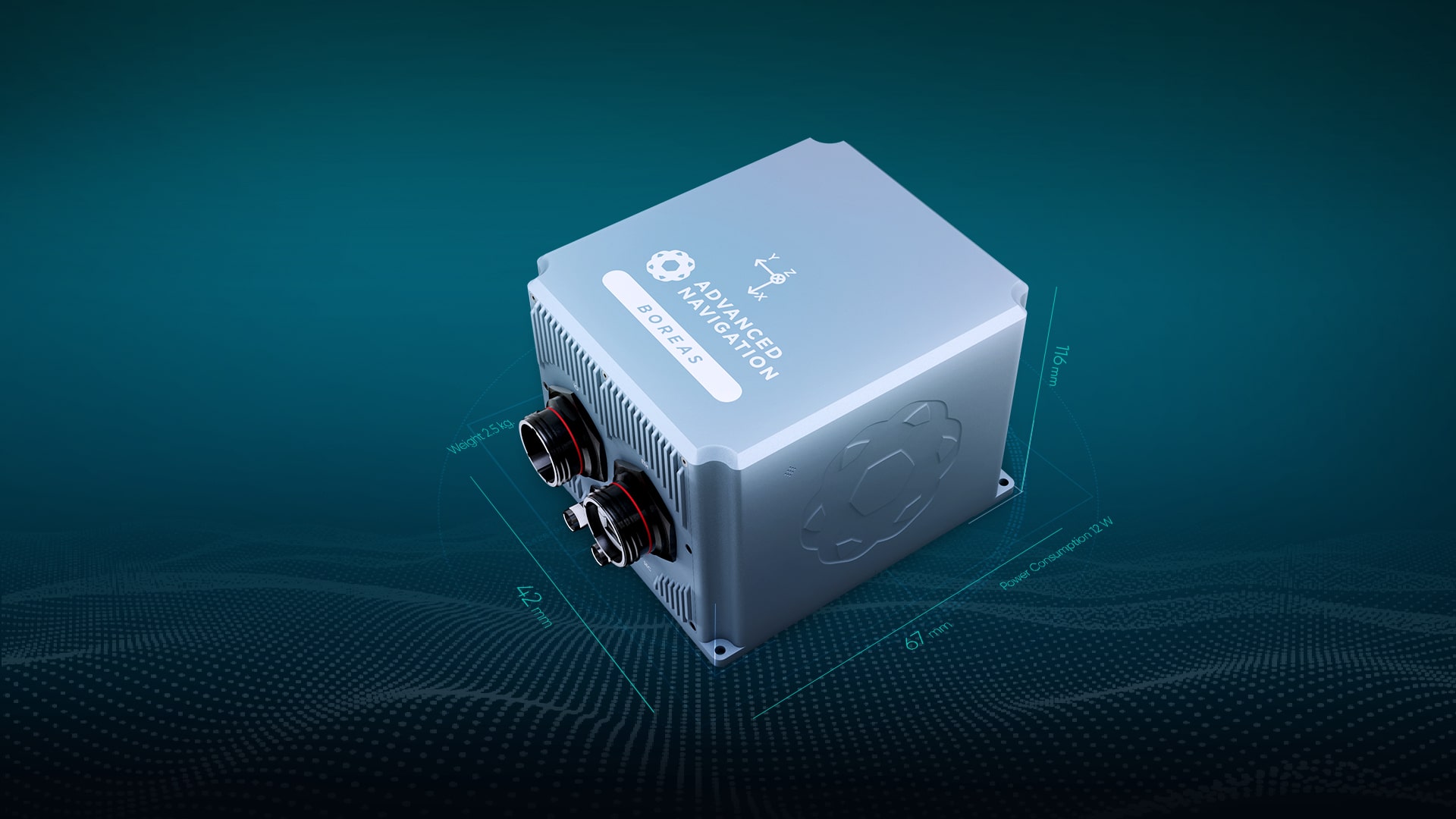
Launching Boreas, The World’s First Fully Digital FOG
26 May 2021
View Post