
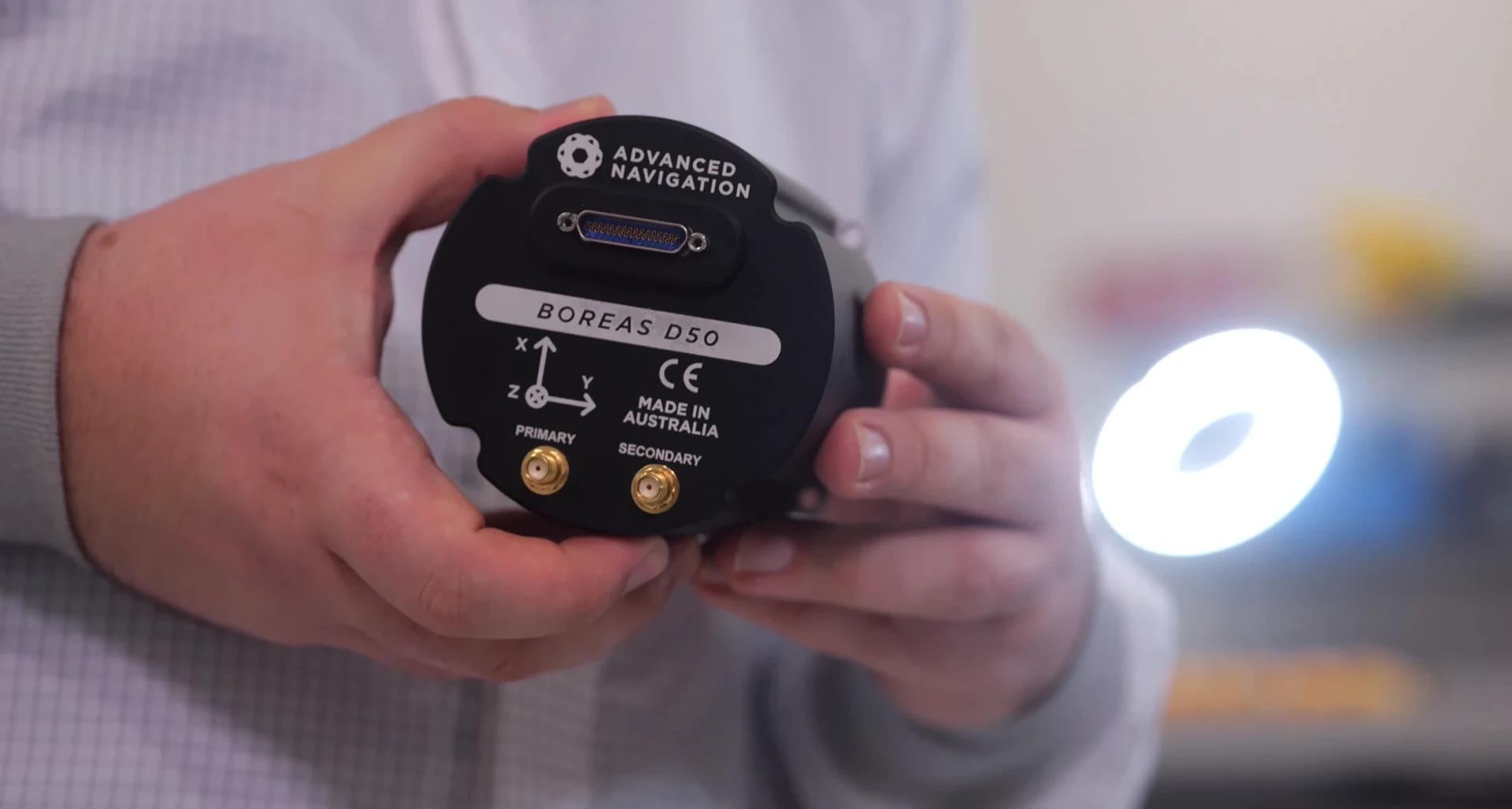
INS vs IMU: The Build vs Buy Navigation Decision for Autonomous Vehicles
Share:
Published on:
Article Summary
- An IMU (Inertial Measurement Unit) is a combination of inertial sensors used to measure motion (typically accelerometers for acceleration, and gyroscopes for rotation).
- An INS (Inertial Navigation System) is an IMU-based navigation system with the necessary hardware and software architecture to calculate the units change in state, and its position, velocity, and orientation, in 3D space.
- An INS is often paired with a GNSS receiver, sometimes called a GNSS-assisted INS.
- An IMU is best for engineering teams who want total architectural control to build proprietary sensor-fusion algorithms and use their own custom intellectual property.
- An INS is best for application-focused teams who need ease of integration and a deterministic navigation solution to reduce integration time and accelerate time-to-market.
Whether you are developing uncrewed ground vehicles for defense or autonomous mining trucks, your vehicle must know exactly where it is in the world, even when GNSS signals fail.
When designing a vehicle’s navigation stack, engineers inevitably face a hardware choice between an INS vs IMU.
These two navigation solutions represent two entirely different approaches to system design. Choosing between an IMU and an INS is a fundamental decision that will dictate your engineering roadmap, resource allocation, and time-to-market.
What is an IMU?
An IMU is the foundational hardware cluster of any inertial navigation setup. It is typically defined as having at least three accelerometer and three gyroscopes, configured in mutually orthogonal axes.
Strictly being a set of sensors , an IMU can only output rate values., i.e., acceleration in three, and rotation in three axes. Therefore, an IMU does not calculate velocity, roll, pitch, heading or position. It is just a set of sensors.
- Accelerometers: Measure specific force (linear acceleration).
- Gyroscopes: Measure angular rate (rotation).
For a deeper dive into what is an IMU, read our complete Tech Article.
Why choose an IMU?
An IMU is the tool for engineering teams who want ultimate control over their inertial stack, or for well constrained applications that explicitly require change in motion data to function, such as robot arms, cranes, linear accelerators, etc. It is also ideal for companies with dedicated teams of state-estimators specialising in navigation systems, often in the pursuit of a bespoke solution to suit their bespoke requirements. These teams want raw data because their proprietary sensor-fusion algorithms will be tuned specifically to their core application, giving them an advantage.
What is an INS?
By comparison an INS is a complete navigation system, which typically combines an IMU with a GNSS receiver (and other sensors), and surrounds it with the computational power necessary to be a powerful, self-contained state-estimation engine.
A typical INS integrates:
- An IMU to measure changes in motion
- A GNSS Receiver to provide satellite positioning (when available)
- A sensor fusion algorithm to fuse the data.
While an IMU provides the heartbeat of raw motion data, it cannot navigate on its own. A system solely working from raw acceleration and rotation values has no understanding of its current motion, orientation, or a suitable reference frame to work within, and thus lacks ability to estimate the change in its state based on this sensor data.
An INS solves this by actively processing the raw data through a highly complex, real-time computational chain:
- Motion sensing: The system’s internal accelerometers measure the forces acting on the vehicle, while its gyroscopes measure how it is rotating. These two independent measurement streams feed continuously into the navigation processor.
- Kinematic integration: The processor integrates the data from both sensors in real time; accelerometer data to track how the vehicle’s velocity is changing, and gyroscope data to track how its orientation is changing. Together, these build a continuously updated estimate of where the vehicle is and where it is pointed.
- Drift correction and sensor fusion: No IMU is perfect. This is a physical limitation, and not a design flaw. The embedded filter continuously compares the running navigation solution against data from the built-in GNSS receiver (or other external aiding sensors), helping it model, track, and then compensate for any errors, so they don’t build up over time..
- Continuous navigation output: An INS delivers a continuous, high-integrity stream of position, velocity, and attitude information, rather than out-of-context streams of raw sensor data.
If the vehicle enters a GNSS-denied environment, the INS relies on its navigation algorithms to dead-reckon, continuing to provide the driver or vehicle control system with location data so it can safely remain on its planned trajectory. Implementing this computational chain from scratch is the primary engineering hurdle teams face when opting for a standalone IMU.
For a deeper dive into what is an INS, read our complete Tech Article.
Why choose an INS?
An INS is the ultimate tool for risk mitigation and speed to market. It is ideal for autonomous vehicles, drone manufacturers, mapping technologies, or companies that wish to remain focussed on their core intellectual property or platform design.
The Build vs Buy Reality
When evaluating an IMU vs INS, the true cost is rarely found on the hardware spec sheet, but in the severe underestimation of the integration hours required to implement a reliable INS.
Purchasing a standalone IMU means committing to building your own navigation system. You are choosing to allocate significantly more time to your highly specialized engineering teams in order to develop, test, and optimize software filters that manage sensor drift and fuse external GNSS data.
Procuring an INS means buying a problem solving tool, which avoids the immense risk of custom sensor fusion, allowing your R&D efforts to remain focused entirely on higher-level vehicle behaviors, such as obstacle avoidance and path planning.
| Feature | IMU | INS |
| System type | Core sensor architecture | Fully integrated navigation engine |
| Data output | High-fidelity linear acceleration & angular rate | Position, velocity, acceleration, rotation, roll, pitch, heading, etc… |
| Primary advantage | Total architectural control and customizability for proprietary algorithms | Accelerated time-to-market with a deterministic, integrated solution |
| Ideal engineering fit | Teams building their own intellectual property and custom filters | Application-focused teams who want to dedicate their resources to higher-level vehicle behaviors |
| Ideal for | Bespoke autonomous platforms, integrated custom payloads, and autonomy developers | Enabled autonomy, rapid prototyping, drones, and autonomous vehicles |
| GNSS integration | Allows you to pair with the exact external receiver of your choice | Seamlessly built-in (with RTK support, where available) for immediate positioning |
Making the Choice between an INS vs IMU
At Advanced Navigation, we develop both. We not only specialize in the design and manufacture of industry-leading standalone IMUs, but these IMUs are also designed into our range of fully integrated INS solutions, with the latest state-estimation algorithms driving our sensor fusion engine. Since we offer both technologies, our only goal is to ensure you select the architecture that best aligns with your engineering bandwidth and project timeline.
If your team is equipped to handle complex, non-linear mathematics and requires raw sensor data to feed into your proprietary navigation stacks, a high-performance standalone IMU will provide the blank canvas you need. Conversely, if your project demands reliable positioning out of the box, without the additional integration requirements, an INS provides the complete navigation package. Moreover, all of our INS solutions can output the raw IMU data, making them suitable for an evolving application development cycle.
Contact our engineering experts today to discuss your specific project requirements and let us help you navigate the IMU or INS decision.
FAQs
What is the main difference between an INS vs IMU?
When comparing an inertial navigation system (INS) vs inertial measurement unit (IMU), the core difference is an IMU is a sensor that outputs raw motion data in the form of “rate” (primarily, three acceleration values & three rotation values), while an INS is a complete system that fuses IMU data with other sensors with complex state-estimation algorithms, which output position and orientation. Ultimately, the choice comes down to whether your engineering team wants to research, test and implement custom navigation math or deploy a ready-to-use solution.
Can I use an IMU for autonomous navigation without an INS?
While an IMU provides the essential motion data, it cannot calculate position or orientation on its own because an IMU is a stand alone sensor. It does not have the additional processing layers to fuse the data streams or estimate the tiny measurement errors that quickly compound into sensor drift. To calculate position and orientation, you must either process the raw IMU data through your own sensor fusion stack or use a fully integrated INS.
Which is more cost-effective for autonomous vehicles: an IMU or INS?
A standalone IMU has a lower initial hardware cost but requires specialized engineering hours to develop the complex algorithms needed for accurate navigation. In the IMU vs INS debate, an INS often proves more cost-effective overall for autonomous vehicles by reducing integration time and accelerating time-to-market.
Recent Tech Articles

Choosing the Right Navigation for Autonomy in Mining
Discover how Advanced Navigation’s Certus and Certus Evo GNSS/INS solutions improve fleet management and scale autonomy in mining.
29 September 2026
Go to Article
Surviving GNSS Denial: Free Inertial vs. Dead Reckoning Navigation
Learn what dead reckoning is in navigation and how it compares to free inertial mode for UGVs and UAVs operating during prolonged GNSS outages.
14 September 2026
Go to Article