Navigating the Future of Mining Operations
Share:
Published on:
Article Summary
The Challenge: Acquiring reliable and consistent navigation data in underground environments remains a barrier to operational safety and realizing the possibility of underground autonomous mining.
The Solution: An INS combined with the Chimera Land LVS delivers long duration positional accuracy and tightly constrains sensor drift in underground mining.
The Outcome: The INS + LVS solution optimizes current below-ground applications today while laying the foundational groundwork for underground autonomous mining operations tomorrow.
For mining executives, the pursuit of operational efficiency, site safety, and overall productivity relies heavily on the quality and continuity of operational data.
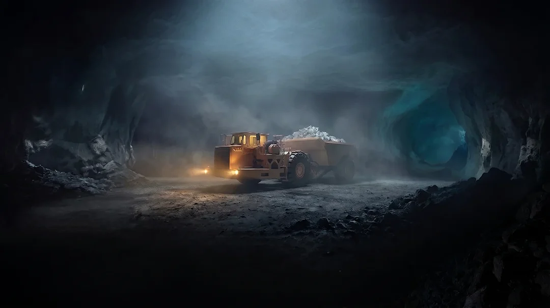
However, acquiring reliable and consistent navigation data in entirely GNSS-denied environments remains a fundamental, industry-wide challenge, especially as the sector continues the pursuit of automation in mining.
Recognising this unmet need, Advanced Navigation has dedicated extensive research and development to engineering a mining navigation solution capable of providing long duration positional accuracy.
Advanced Navigation’s Chimera Land
Developed by Advanced Navigation’s dedicated Photonics team, spearheaded by physicists Dr James Spollard and Dr Lyle Roberts, the Chimera Land Laser Velocity Sensor (LVS) represents a forward shift in mining navigation technology.
The Chimera Land LVS provides highly accurate 3D body velocity updates to improve the capabilities of an Inertial Navigation System (INS), built for semi-autonomous and crewed mining and military applications.
The LVS was designed to significantly improve an INS when integrated as a velocity aiding companion. When an INS loses GNSS signals, it relies entirely on dead-reckoning to estimate its position, a process that inevitably leads to sensor drift and compounding errors over time. By pairing a high-grade INS with the LVS, the system is fed reliable 3D velocity updates.
This velocity aiding effectively anchors the INS, delivering exceptional long-duration dead-reckoning. Rather than exhibiting erratic jumps or snapping to an incorrect grid, the INS and LVS combination delivers precise positional output characterised by a smooth, continuous trajectory, with a well constrained error profile. The result is an integrated solution that delivers the behavioural consistency required to be effective underground.
Laying the Groundwork for Mining Applications
Deploying new technology deep within a mine pit is rarely a simple plug-and-play endeavor; it requires a pragmatic, staged approach. While discussions around navigation often skew toward distant, fully autonomous mining operations, the core technology of the LVS serves as a highly precise building block for the mining industry. It provides forward-thinking operators with the reliable, continuous localisation data necessary to begin trialling and incrementally integrating advanced capabilities into their existing underground frameworks.
Underground localization
The INS + LVS can provide continuous, high-fidelity positional data of underground assets, without the need for a comprehensive, expensive, and extensive underground infrastructure.
Fleet management
The INS + LVS enables visibility and accountability over underground assets, reconciling work completed vs. work requested, strategic mine planning improvements, including traffic optimisation, and the ability to combine vehicle telemetry with time stamped geolocation data that improves pre-emptive maintenance scheduling.
Underground haulage
Similar to fleet management, the INS + LVS ensures that trucks can navigate complex underground environments, remain accountable while working to plan, which improves material handling traceability, reducing ore quality dilution.
High-precision machine guidance
The INS + LVS assists operators of continuous miners, drill rigs, and loaders, with improved spatial awareness and geolocation consistency. For continuous miners, improved drive distance measurements and directionality results in more efficient development. With drill rigs, improvements in roof bolt placement or production drill pattern consistency leads to increased safety and extraction efficiency.
Proven in Extreme Environments
For those evaluating the integration of new technology, theoretical capability must be backed by rigorous, real-world validation. Before its official launch, the Chimera Land technology was subjected to trials in the most navigationally challenging environments on the planet.
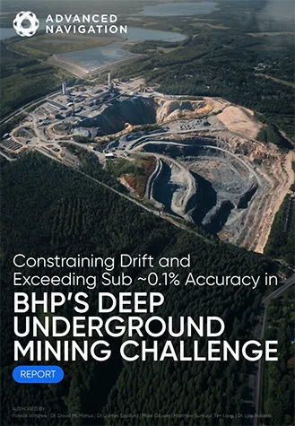
Advanced Navigation was selected to participate in BHP’s prestigious Think and Act Differently innovation program. Chosen as a finalist from a highly competitive pool of over 90 global applicants, the organisation was tasked with trialling the LVS’ long duration positional accuracy deep underground in Europe’s deepest mine, the Callio Mine in Finland.
The subterranean environment at Callio was a true test of endurance and precision, characterised by deep vertical shafts, steep inclines, and utter isolation from satellite signals. During the trial, the combined Boreas D90 INS and LVS solution delivered a remarkably low 55cm of error over 6 kilometers underground. This level of sustained precision in a completely GNSS-denied zone effectively rewrites the expectations for underground localisation.
The operational resilience of the LVS extends beyond the mining sector. The technology has successfully undergone defense trials with the U.S. Army. Operating in heavily contested environments where electromagnetic warfare and signal jamming were deliberately applied, the LVS achieved a 0.012% error per distance traveled (7.5m over 65km).
Opening the Door to the Future of Autonomy
Underground autonomous mining operations, where fleets of uncrewed development vehicles safely (and efficiently) navigate, extract, and haul resources with minimal human intervention, has long been considered a distant dream. One of the more significant barriers to this reality is the lack of reliable, continuous, and highly precise localisation data where there is little to no infrastructure.
As the need for mining operations to go deeper, the scalability and the complexity of the technology used to navigate these environments must evolve in kind.
The pairing of Advanced Navigation’s INS with an LVS represents a step forward in navigational performance for the mining sector, providing highly available and reliable localisation data, with well constrained drift over time.
While an INS and LVS combination alone does not instantly deliver a fully autonomous mine overnight, Advanced Navigation is laying the groundwork upon which true underground autonomy could eventually be realized.
Contact Advanced Navigation today for enquiries about the Chimera Land Laser Velocity Sensor and discover how to integrate navigational precision into your underground operations.
22 km Traversed at 1400m Depth. Sub-0.1% Error Rate.
See how our Fiber-Optic Gyroscope Inertial Navigation System combined with our Chimera Land Laser Velocity Sensor demonstrated long-range navigational accuracy in Europe’s deepest underground mine.
See the Trial Results
FAQs
Why does the Chimera Land LVS need to be paired with an INS?
While an INS is effective for underground navigation, it remains vulnerable from compounding sensor drift when isolated from satellite signals in underground environments. Pairing it with the LVS provides highly accurate 3D velocity updates that limit this drift over extended distance traveled, providing the sustained, reliable precision required for deep mining operations.
How does the INS and LVS combination support the transition one day to underground autonomous mining operations?
True autonomy requires continuous, highly reliable localization data to safely navigate equipment in complex, GNSS-denied environments without human intervention. This integrated technology provides the foundation and spatial awareness necessary to eventually one day transition to the possibility of underground autonomy.
Recent Tech Articles
How Improved Positional Accuracy Can Transform Mining Excavation
Explore the new standard in absolute positioning for GNSS-denied environments. See how the Chimera Land LVS and INS pairing anchors real machine motion.
15 June 2026
Go to Article
High-Precision Navigation at Scale for Counter Drone Technology
Unlock precision for your kinetic effector on-the-move. Discover how Advanced Navigation delivers the stabilization and supply chain speed needed for scalable counter drone defense.
18 May 2026
Go to Article