How a Compact North Seeking Gyro Delivers Precision Underground
Share:
Published on:
Article Summary
The Challenge: In underground mining, heavy magnetic interference and sensor drift can compromise navigation accuracy.
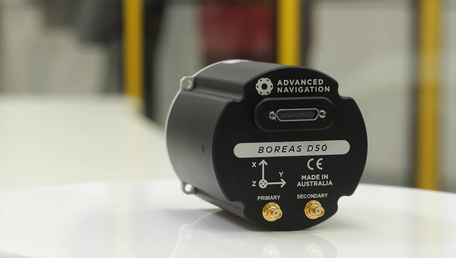
The Solution: Advanced Navigation’s Boreas 50 Series is a rugged and compact north seeking gyrocompass that establishes accurate azimuth beyond external references.
The Outcome: Achieve continuous, high-precision underground pointing and orientation, reduces manual re-surveying delays which helps maximize overall productivity.
In underground mining, the most expensive machine is the one that isn’t moving.
Right now, your drill rigs and loaders are reliant on fixed infrastructure when it comes to knowing their orientation and location.
While many variables go into keeping a machine on its tramming path, heading availability is one of the most important measurements for development and navigation underground.
It is also one of the hardest to maintain, especially in development areas.
Consequently, this makes the north seeking gyro not just a piece of technology, but the operational link between a machine that is cutting rock versus a machine that is waiting for a surveyor.
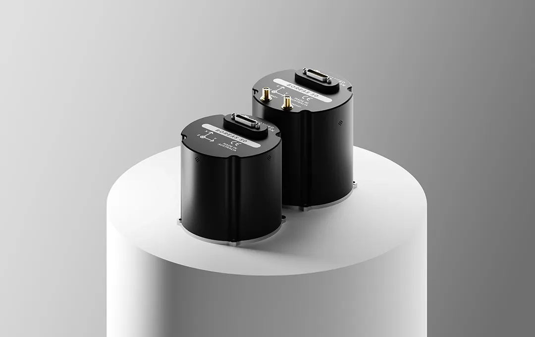
Compact Precision in the Boreas 50 Series
Advanced Navigation’s Boreas 50 Series offers smaller, lighter and faster than legacy fiber-optic gyroscopes (FOGs), while also being easier to integrate on the vehicle. This opens the door to vehicle-based alignment while developing a heading, as opposed to waiting for surveyors or slower external systems.
1. Performance without the bulk
In mining, a smaller size unit that can be tucked away out of harm’s reach often requires trading compactness for reduced performance.
Typically, if you wanted a highly accurate north seeker, you had to accept a large, power-hungry box. The Boreas 50 Series breaks this ratio with a compact, low SWaP-C design.
- Dimensions: At approximately 94 x 94 x 85 mm, it is a compact cylinder that increases the number of available installation locations.
- Rugged: At almost 1kg, the internals are tightly packed and designed to handle shock and vibration beyond legacy systems.
- Accuracy: It is a north seeking gyrocompass delivering a heading accuracy of 0.5° (secant latitude RMS).
2. Ruggedness for the face
Mining equipment, similar to systems in the defense industry, is often subjected to heavy vibration and shock loading.
The Boreas 50 Series was designed for this. It is certified to MIL-STD-810H for environmental ruggedness and MIL-STD-461 for electromagnetic compatibility.
3. Speed of operations
Older gyrocompasses of similar performance take significantly longer to initialize, determine their heading, and settle on an accurate value, delaying the start of a shift or the current operation. The Boreas 50 Series is engineered to be a fast north seeker, and furthermore, implements AdNav Intelligence – the latest in sensor fusion algorithms, which are currently considered as the bleeding-edge among state estimation experts.
Additionally, when combined with our holistic software solutions geared towards ease of use, faster integration, and tools that assist you through your commissioning phase, we aim to streamline the process of adoption, such that the ultimate end user can rapidly gain value from their investment.
Opening the Door to Future Autonomy
Heading and orientation are only one set of vehicle parameters that are critical for operating beyond the fixed infrastructure, due to the complexity of the underground world.
Whether you are moving toward semi-autonomous fleets or a hybrid mining environment first, your machines must become self-sufficient once they travel out of range of the fixed infrastructure. Having a vehicle-based sense of absolute direction will be one of the key capabilities that opens the door to a future navigating beyond fixed infrastructure.
Therefore, installing a compact north seeking gyrocompass, such as the Boreas 50 Series, is not only future-proofing your fleet, but opens the door for more complex autonomy tasks. When combined with novel aiding-sensors such as Advanced Navigation’s Chimera Land Laser Velocity Sensor, you are building into each vehicle the foundational layer of independent, self-sufficient navigation.
Moreover, years of experience and data collection will be crucial for pushing the boundaries of the technology, whilst navigating the underground independently.
Why Choose the Boreas 50 North Seeking Gyro
In underground mining, heading is one of the more operationally important measurements, yet remains underutilised because it is often unavailable or unreliable for operators or machine guidance systems in development areas. Fixed infrastructure can address many navigation challenges once it is established, but during development, heading is often intermittent, indirect, or procedurally derived rather than continuously available on the machine.
The Boreas 50 Series assists by making absolute heading a vehicle-based capability. By delivering fast, north-seeking heading in a compact, rugged form factor, it provides a consistent reference that can be used whenever alignment or orientation matters, without reliance on external systems. This does not replace broader navigation methods, nor does it eliminate the need for established processes. However, it reduces dependence on them at the moments where heading uncertainty would otherwise accumulate.
In doing so, it provides a practical and economical way to improve heading availability in development environments, supporting more consistent operation and better use of existing machine capability.
Contact our team today to discuss how the Boreas 50’s north seeking gyrocompass can improve your underground navigation reliability and maximize shift productivity.
22 km Traversed at 1400m Depth. Sub-0.1% Error Rate.
See how our Fiber-Optic Gyroscope Inertial Navigation System combined with our Chimera Land Laser Velocity Sensor demonstrated long-range navigational accuracy in Europe’s deepest underground mine.
See the Trial Results
FAQs
How does a north seeking gyro work?
A north seeking gyrocompass measures the Earth’s rotation rate to determine the precise direction of the planet’s axis relative to the sensor. This allows the system to calculate an absolute azimuth autonomously, independent of magnetic interference.
How does an INS determine orientation?
Calculating roll and pitch is straightforward using gravity vectors. However, calculating heading (azimuth) without GNSS is exponentially more difficult. An INS must detect the rotation of the Earth to establish a reference. This requires incredibly sensitive internal components capable of measuring minute angular rates even amidst the noise and vibration of active mining machinery.
Recent Tech Articles
How Improved Positional Accuracy Can Transform Mining Excavation
Explore the new standard in absolute positioning for GNSS-denied environments. See how the Chimera Land LVS and INS pairing anchors real machine motion.
15 June 2026
Go to Article
High-Precision Navigation at Scale for Counter Drone Technology
Unlock precision for your kinetic effector on-the-move. Discover how Advanced Navigation delivers the stabilization and supply chain speed needed for scalable counter drone defense.
18 May 2026
Go to Article