Are Autonomous Haulage Stoppages Frustrating You?
Share:
Published on:
Article Summary
The Challenge: Autonomous haulage trucks stop due to frequent GNSS signal or RTK loss, causing losses in production and significantly reducing operational efficiency for mining companies.
The Solution: Maintain accurate position and heading through GNSS-degraded environments by integrating Advanced Navigation’s positioning solutions, targeting the root cause of stoppages.
The Outcome: A resilient autonomous fleet that maximizes cycle time efficiencies, safeguarding the multi-million-dollar Autonomous Haulage System (AHS) investment and boosting the mine’s profitability.
The scene is a familiar one for you.
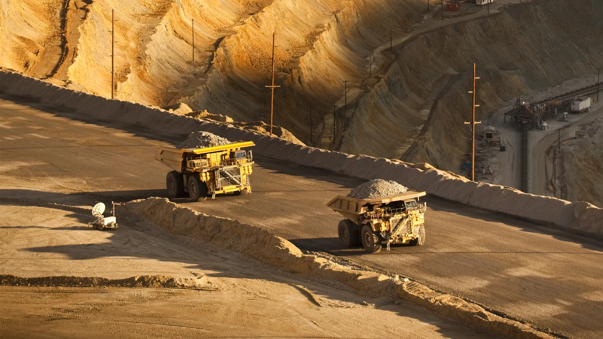
On the digital dashboard, your newest fleet of autonomous haulage trucks, each a multi-million-dollar asset, move across the site map like clockwork. The promise of automation, unprecedented productivity, enhanced safety, and operational precision is being realized.
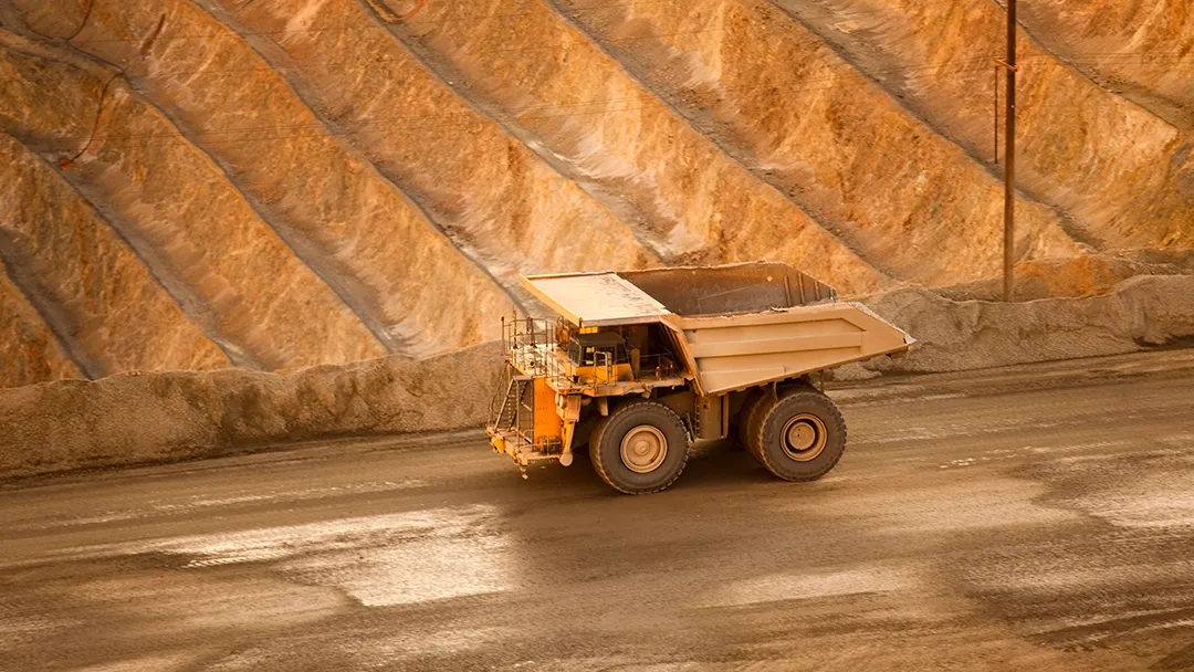
Then, an icon flashes red. A 400-tonne haul truck with valuable ore, has stopped dead in its tracks at the bottom of the pit.
It hasn’t broken down. There’s no physical obstruction. The truck’s GNSS has degraded, and its safety protocols have done exactly what they were designed to do: stop.
For you, this single stoppage becomes a direct hit to your key performance indicators. The clock is now ticking, and every second of idle time translates into lost production. This is the daily reality of the AHS blind spot, and it has serious financial implications for the mining sector.
What is the Cost of Autonomous Haulage Truck Stoppages?
The accountability for AHS performance falls squarely on the shoulders of operational leaders. When a truck stops, a chain reaction begins. The excavator it was servicing now sits idle. The crusher it was feeding will soon be starved of material. Other trucks on the circuit must be rerouted, creating potential traffic issues and disrupting the carefully planned operation.
Putting this into perspective, most AHS fleets budget hundreds of hours per year of downtime. Depending on the scale of the site, this could result in millions of dollars per year, based purely on lost opportunities.
This downtime is often made-up of many small stoppages, which presents an opportunity for increasing yield if those small stoppages can be prevented. This helps maximize the ROI of the haul fleet, or allows the mine to reach their ever-increasing production goals.
What is the Consequence of Relying Solely on GNSS?
To prevent any risk, the AHS is programmed to do the only safe thing it can do; stop.
For an autonomous haulage to function efficiently, it relies on a continuous stream of centimeter-level accurate data, typically delivered by Real-Time Kinematic (RTK) corrected GNSS. The critical point of failure (and the direct cause of most vehicle stoppages) is not a total loss of all satellite signals, but the temporary degradation or loss of an RTK fix.
This degradation is frequently triggered by a variety of common mining conditions, such as a truck driving alongside a high wall, passing metallic infrastructures, or navigating through deep sections of a pit, where some satellites are also obscured. In these moments, the positioning solution downgrades from centimeter-level RTK to a less precise GNSS mode, where its accuracy can suddenly fall to several meters.
While the truck still has a basic position, this meter-level accuracy is below the minimum threshold required for autonomous operations. To prevent any risk, the AHS is programmed to do the only safe thing it can do; stop. This single, predictable failure point is what compromises the resilience of the AHS fleet and directly impacts cycle time efficiencies.
This is precisely the scenario where a high-performance inertial navigation system (INS) is essential. It provides the continuous, high-accuracy data needed to keep the haulage truck moving through intermittent outages until the RTK fix is naturally regained, enhancing the resilience of the AHS and preserving the integrity of the production plan.
How Can Advanced Navigation Help You Maximize Profitability?
What if your trucks could continue their mission safely and accurately, even during a GNSS interruption?
At Advanced Navigation, our INS solutions are designed to provide your AHS fleet with accurate position, velocity, acceleration, and orientation – building resilience against such short interruptions.
Our INS leverages state-of-the-art sensor fusion algorithms and high-performance MEMS gyroscopes and accelerometers. This technology delivers a superior calculation of position, orientation, and velocity, even independent of any external signals.
This is precisely the capability that our Certus Evo INS provides for autonomous haulage vehicles.

Our Certus Evo integrates its powerful inertial measurement unit with a dual-antenna, multi-constellation GNSS receiver.
Here’s how the Certus Evo solves your challenges:
- Seamless sensor fusion: Our Certus Evo integrates its powerful inertial measurement unit with a dual-antenna, multi-constellation GNSS receiver. In normal operations, the system blends GNSS and inertial data to produce a position accurate to within centimetres.
- Confident dead reckoning: When GNSS signals are lost, the INS core seamlessly takes over, using the last known position and the continuous stream of inertial data to “dead reckon” the truck’s path. As our Certus Evo is calibrated for high levels of performance in any mining environment, this dead reckoning capability can bridge outages for several minutes with minimal drift. This is the key to creating a resilient fleet, ensuring your assets keep producing value instead of sitting idle.
- Rapid reacquisition: The moment a clear GNSS signal becomes available again, the system reacquires a fix, rapidly correcting any minor drift and continuing with GNSS-enhanced accuracy.
With the right technology, your autonomous haul truck will continue on its route, maintaining speed and direction, and arrive at its destination without unnecessary downtime.
Enhance Your AHS With Reliability and Precision
Integrating Advanced Navigation’s INS technology into your AHS fleet is an effective way to mitigate the risk of GNSS-related lost production. The benefits are direct and measurable:
- Maximize uptime: Through eliminating stoppages in deep pits, near high walls, and during atmospheric events, you convert idle time directly back into productive haulage cycles.
- Streamline integration: Achieve faster deployment with our vehicle-agnostic hardware. Our systems are designed for seamless integration, reducing engineering complexity and timelines.
- Protect your ROI: A reduction in AHS stoppages allows your multi-million-dollar autonomous fleet to operate at its full potential, safeguarding the business case upon which the investment was made.
- Enhance operational predictability: Create a resilient and predictable haulage circuit by feeding the dispatch system the continuous, high-integrity position data it requires to optimize fleet movements and execute plans with confidence. Through eliminating positioning dropouts, autonomous haulage vehicles remain visible and taskable, ensuring the entire circuit is more resilient to common interruptions.
- Secure supply chain: Our resilient supply chain ensures rapid production and delivery against stringent timelines, overcoming long lead times that can derail AHS project schedules. And as our products are ITAR-free, you can avoid complex export controls and administrative hurdles
Investing in a superior INS is a direct investment in a more resilient autonomous fleet that maximizes cycle time efficiencies, ultimately safeguarding your AHS investment, and boosting the mine’s overall profitability.
To learn more about how Advanced Navigation can fortify your AHS deployment, contact our team today. We provide not just technology, but a partnership built on in-field expertise to ensure your success from integration to operation.
FAQs
Is an INS reliable enough to prevent stoppages completely in GNSS-degraded zones?
An INS solves this by fusing internal gyroscopes and accelerometers with odometry to calculate the vehicle’s position, supporting its resilience through degraded satellite signals. When GNSS is lost, the system navigates by “dead reckoning”, with enough accuracy to keep things moving. This purpose-built functionality can improve the uptime of your autonomous haulage vehicles to operate continuously.
How complex is it to retrofit an Advanced Navigation solution onto our trucks?
Our products are designed with ease of integration in mind, using standard communication interfaces and protocols, including Ethernet, RS422/232, and CAN bus, to minimize complexity. The integration process is streamlined to reduce vehicle downtime, and feed high-quality data directly into the existing control system of the autonomous haulage vehicles.
Recent Tech Articles
How Improved Positional Accuracy Can Transform Mining Excavation
Explore the new standard in absolute positioning for GNSS-denied environments. See how the Chimera Land LVS and INS pairing anchors real machine motion.
15 June 2026
Go to Article
High-Precision Navigation at Scale for Counter Drone Technology
Unlock precision for your kinetic effector on-the-move. Discover how Advanced Navigation delivers the stabilization and supply chain speed needed for scalable counter drone defense.
18 May 2026
Go to Article