Maintaining 0.03% Airborne Accuracy Without GNSS Aiding
Share:
Published on:
Background
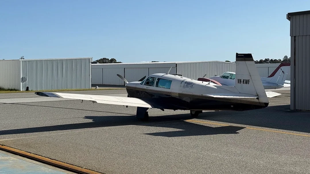
Advanced Navigation evaluated the resilience of its assured navigation architectures across two distinct Size, Weight, Power, and Cost (SWaP-C) profiles. Flight trials were conducted aboard a Mooney 201 (M20J) aircraft operating at altitudes of 400 to 500 meters in Western Australia to demonstrate precise airborne positioning in GNSS-denied conditions.
Challenge
As global navigation threats escalate, operating in GNSS-contested or denied environments has become a vulnerability for aviation. When GNSS signals degrade, jam, or are actively spoofed, aircraft lose trusted positioning, which threatens mission success and platform survivability. Relying on a single navigation technology in these environments is no longer viable. The challenge was to deliver continuous, reliable Positioning, Navigation, and Timing (PNT) for both crewed and uncrewed platforms when external signals fail.
Solutions
Advanced Navigation successfully demonstrated its inertial-centric architecture, which blends inertial data with aiding technologies in real time. The validated configurations included:
- Certus Evo + Air Data Unit: Designed for lightweight, low-cost UAVs and ISR platforms, the configuration fused a high-performance MEMS Inertial Navigation System (INS) with pitot airspeed and barometric altitude data.
- Boreas D90 + Laser Velocity Sensor (LVS): Built for long-range missions, the setup fused a Fiber Optic Gyroscope (FOG) INS with a LVS to provide long-term stability and navigation.
- AdNav Intelligence: The software engine validating all sensor inputs, dynamically adapting to signal degradation, vibration, and atmospheric conditions to ensure continuous navigation.
Outcome
The flight demonstrations successfully validated the architectures as highly resilient, achieving continuous positioning without GNSS. The trials yielded the following accuracy results:
Boreas D90 + LVS Results
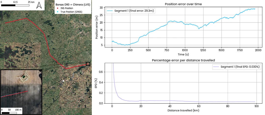
Over 100 km, the system recorded only 29 metres of error – a mere 0.03% of the total distance.
Certus Evo + ADU Results
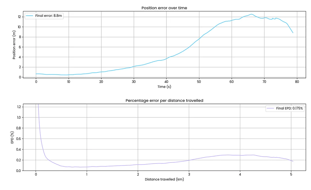
Over 5 km of flight, the system achieved an error of just 8.8 metres – a remarkable 0.17% of the total distance travelled.
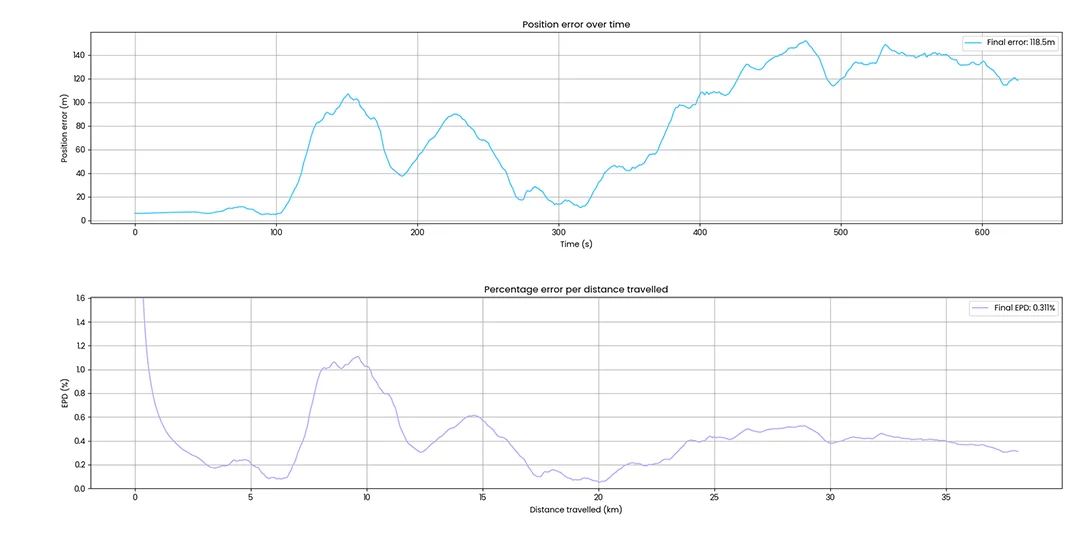
Over a longer 35 km mission, the same setup achieved 118 metres of error, maintaining 0.3% accuracy despite GNSS signal absence.
These results proved that Advanced Navigation’s sensor fusion can guide uncrewed aerial systems through electromagnetic warfare conditions and contested air domains, ensuring mission continuity independent of GNSS.
For more information about the full validation, read our technical article.