Key Points
- With the GNSS Compass, Nortek could rely on a cost-effective solution to provide accurate heading to assist ADCP that satisfied their stringent requirements and enhanced their overall solution.
- The GNSS Compass improved the speed and simplicity of set-up and supported Ethernet connectivity for high-speed data communications.

Nortek, United States
Nortek designs, develops, and produces instruments that apply the Doppler principle to underwater acoustics in order to measure and profile water-based phenomena. This includes currents and velocities, waves, and the movement of water-borne biomass, for example. These instruments are used by scientists, researchers, and engineers around the world to help understand the behaviors of seas and waterways. This often means an operation in demanding environments that require reliability as well as state-of-the-art technology.
Nortek’s Signature VM vessel-mounted ADCP package opens up new opportunities to the survey community while offering operational convenience and reduced complexity. Data quality can be optimised, and both errors and initial installation time can be substantially reduced by using components that are integrated at a high level.
Herman Huitema, VM Product Manager, reveals how his team used Advanced Navigation’s GNSS Compass in their surveying solution.
The challenge: Reliable and accurate heading to assist ADCP
A vessel-mounted ADCP measures and logs water velocity and direction below the vessel to create a profile of what is happening beneath the water surface. In order to quantify and correct the measured data for accuracy of position, ADCP measurements typically require a precise secondary reference for velocity and heading that is highly reliable. Besides using ADCP bottom tracking functions, referencing data can be provided using an external GNSS receiver and a non-magnetic heading source, such as a gyro-compass.
The use of external correction sources has traditionally been challenging to interface with ADCP data. Additionally, synchronisation between the systems must be completely dependable, as any delays in heading and velocity data can significantly deteriorate the integrity of ADCP data. Nortek sought to find a solution that provided accurate heading to assist ADCP for their latest platform with a view that it would cater for existing needs and remain viable into the future.
The solution: GNSS Compass provides ready integration and accuracy
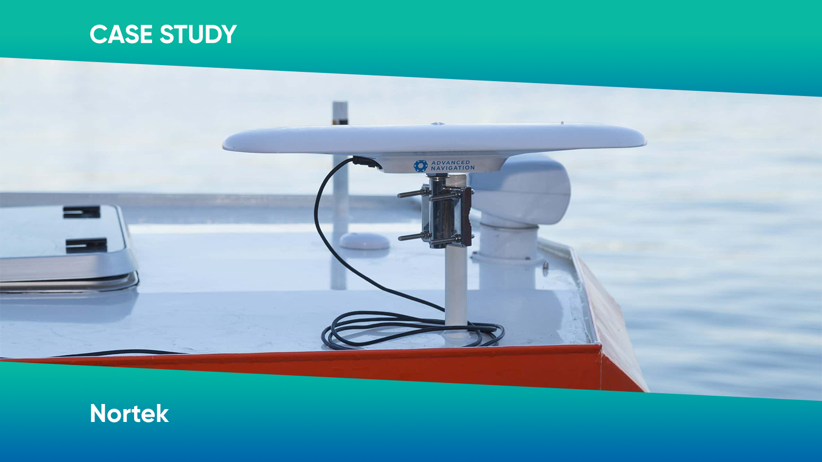
The GNSS Compass provides the necessary satellite-derived geographical information for position and velocity. It also delivers accurate non-magnetic heading via its integrated dual GNSS antennas. All components are built into a tough, marine tolerant housing with a standard screw-mount.
Data synchronisation issues of past serially connected equipment are virtually eliminated, with nanosecond accuracy via Ethernet PTP connectivity between the ADCP and GNSS Compass. Similarly, common Ethernet-based compatibility provides a much simpler set-up and reliable high-speed data transfer to previous technologies.
”GNSS Compass is an easy, time and cost-effective instrument
Herman HuitemaVM Product Manager, Nortek


The result: Advanced technology simplifies integration
The GNSS Compass has proven to be an ideal companion instrument to the Signature VM ADCP. The fact that it can replace a GNSS and gyro-compass with a standalone unit that has a single Ethernet connector and supports a proprietary protocol provides enormous benefits in reducing set-up time and not requiring specialised knowledge.
Nortek’s integration of the GNSS Compass to their Signature VM package provides a high-level vessel-mounted ADCP/navigation solution. It also offers a rapid and easy set-up experience that users expect from the latest technologies and integrations.
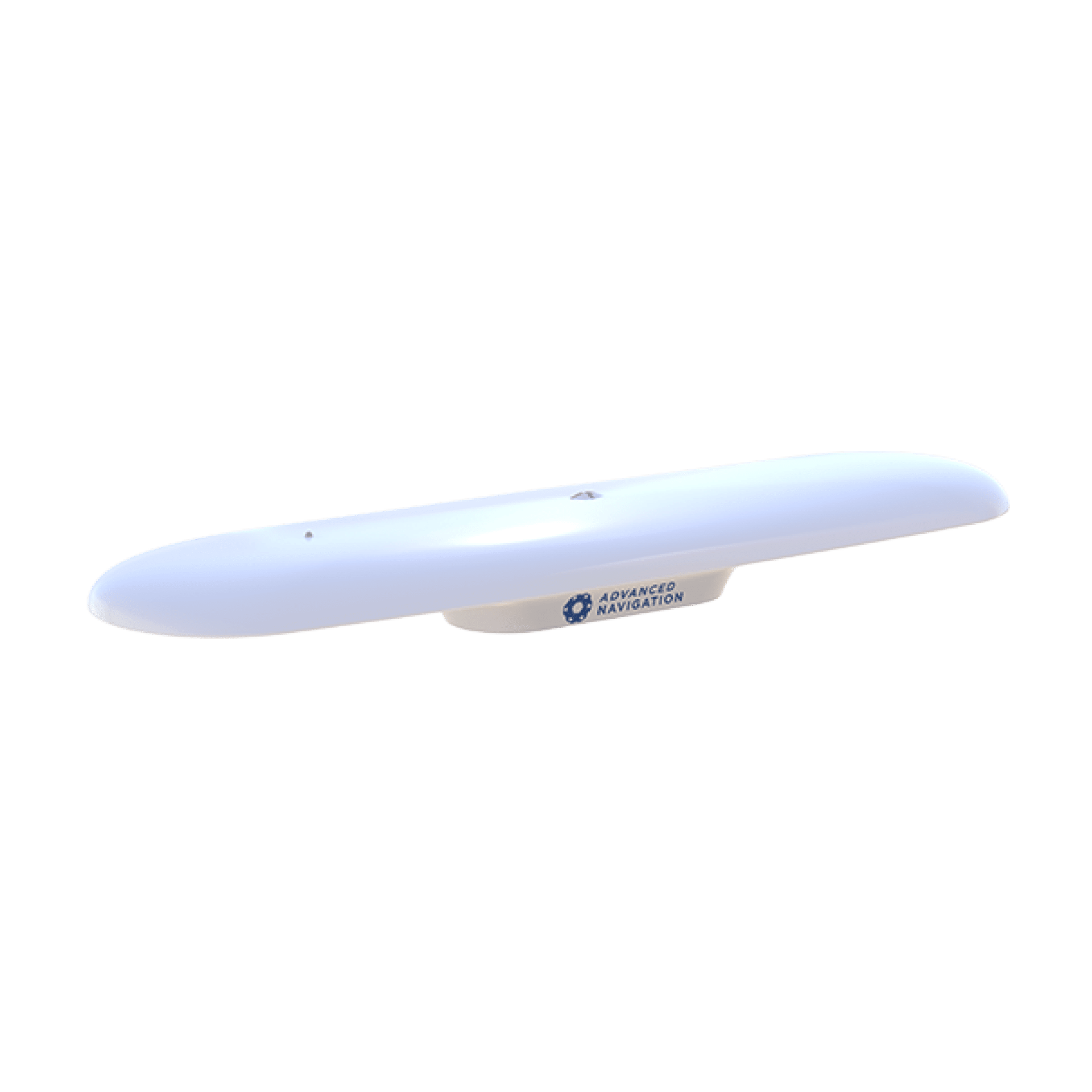
GNSS Compass
The GNSS Compass is an all-in-one GNSS/INS navigation and heading solution. It provides accurate dual-antenna GPS-based heading that is not subject to magnetic interference and can maintain accurate heading during GNSS outages of up to 20 minutes. It features high accuracy RTK positioning and is plug and play with NMEA 0183, NMEA 2000, and Ethernet interfaces.