Case Study
Published on:
LimnTech Scientific, United States
The mission of LimnTech Scientific, Inc. is to provide superior products and services to the roadway marking industry. LimnTech Scientific is a for-profit organization and invests its profits for growing the business and for continually improving and developing innovative products and services for the benefit of our customers.
LimnTech Scientific, Inc. designs and manufactures GPS-based machine vision systems for the roadway marking industry. These patent-pending systems improve worker’s safety, increase efficiency, and decrease labour costs.
Road marking is an essential element of our typical daily travel lives. Bright, visible markings not only make finding our way and understanding the route ahead easier, but are essential in making roads safer for motorists and pedestrians alike. We may take road marking for granted, however, with constant increases in road networks, regular grinding and repaving of road surfaces and the need to repaint worn and faded line-work makes the road marking segment a major operation in many countries.
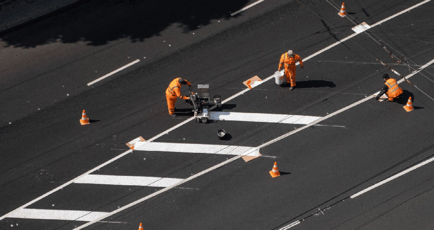
The most common means of road marking is a very manual process. Manual marking typically means using measures to obtain the necessary distances from curbing and string lines to create the initial travel path for the painting vehicle. The painting vehicle then follows, with a driver and a paint operator in the back of the vehicle. The paint operator ostensibly follows the path visually, adjusting the paint gun carriage alignment with the markings and activating the spray guns as required. This process is slow and capable of somewhere between 0.8 to 1.5 km (0.5 to 1 mile) per hour.
Using technology to take road workers out of harm’s way is a top priority
“Our focus is on saving lives. Every one of our customers has had someone hit or been killed doing this work. LimnTech Scientific was born out of that desire to make a change.”
Chris Davies, Chief Marketing Officer, LimnTech Scientific
The manual process requires a crew to place and remove safety marking cones and signage and other protection systems, perform measurements and create the line path markings. This means a lot of people moving ahead, around and behind the painting vehicle. To make matters worse, roads are generally not closed when marking is carried out and this places layout crews and paint operators at huge risk of injury through accidents. The sad reality of people being injured and killed while road marking spurred the design team at LimnTech Scientific to find and develop new ways that would take workers off the roads and make the whole road marking process safer and more efficient.
In 2010, the concept of an automated painting system was first drafted, with LimnTech Scientific formed in 2012 to bring the idea into reality. The challenges in designing a practical solution that would meet the brief of higher safety and efficiency were several fold. Nominally:
With above requirements met, the LifeMark system was created. The LifeMark system uses an AI-enhanced machine vision camera or laser technology that is capable of determining line markings or remnants of markings in almost any condition. In conjunction with the detection system, a GNSS-based MEMS INS navigation system is used to stamp location data for roadway markings. Real-time kinematics (RTK) for location data is used to enhance accuracy down to <50 mm (2”). All road survey data is stored in the cloud for future use. After surveying, the driver of the painting vehicle uses the control panel to follow the route markings – the paint carriage and spray system automatically apply the paint at the correct locations, without requiring workers on the road. By storing the road marking locations, the work can be repeated without having to survey the road again beforehand. The road marking survey can be carried out at actual traffic speed (up to approximately 130 km/h (80 mph) and the painting at a pace of approximately 24 to 32 km/h (15 to 20 mph). The speed of this automated system represents massive savings in time and greatly increased safety, however, it requires a navigation system that can deliver reliable data for as long as possible.
The team at LimnTech Scientific and sister company, Guidemark have more than 900 years collective experience in line marking systems machinery design and manufacturing to draw on. It is a goal for the company to not only remain at the top of the industry but to lead it in terms of adopting the latest robotic and smart automation technologies that assist their clients in delivering safer roads, safer working environments more efficiently and cost effectively than ever before. To do this requires rugged, reliable equipment with very high levels of dependability in conditions that can affect GNSS.
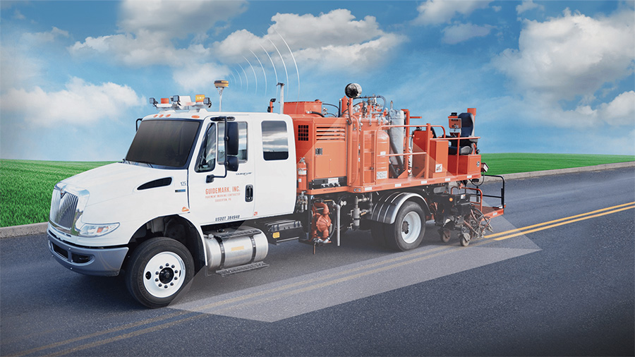
A road marking truck equipped with the LimnTech Scientific LifeMark system
Accurate and reliable navigation in rural and urban environments often means dealing with dense tree coverage, overpasses, buildings and tunnels that can all frequently disrupt and deny GNSS reception. For customers, availability of the system is paramount as any time it is not available, additional resources are required. From the perspective of commercial viability, customers generally require a minimum 50% system availability. This places great emphasis on the navigation system being effective in adverse conditions for as long as possible. The deeper you can go into territory that can affect the navigation system and still maintain automated operation, the more efficient the overall solution is and the less time is spent reverting to manual processes.

Heavily forested areas can be a big challenge to satellite-based navigation for automated road marking
The first commercially viable version of the system used Spatial Dual GNSS INS, which provided good, consistent performance, particularly in more open-sky areas. However, as adoption of the system became more widespread, some of the conditions under which the system was expected to work became increasingly difficult. In the heavily wooded New England area of the United States, where roads are often narrow and closely lined by tall trees as a case in point, the system designers wanted to provide better performance and system availability. This prompted the research and development team to look at improving accuracy and reliability of the GNSS MEMS navigation system in these very difficult environments.
During 2018, the LimnTech Scientific designers experimented with the Advanced Navigation Certus MEMS INS and four other MEMS-based GNSS INS, each from a major manufacturer. Testing also included trialling different antenna and navigation system combinations. Using routes that presented considerable satellite reception issues as a testing ground, the team were able to collect data from each test and overlay them to determine which provided the best accuracy. Armed with this data, the Certus was chosen as the most reliably accurate system. The solution uses RTK base station GNSS correction data to consistently tighten navigational accuracy to sub-50 mm (2 “), which is providing very good results. The example image below shows maps of a test route near Burtonsville, Maryland US for Certus MEMS INS (right) and a similar product (left). The blue lines indicate where the system was performing with operational accuracy.

Certus MEMS (right) provided very significant gains in system availability during extensive testing against several MEMS navigation systems (similar product shown on left)
All Advanced Navigation systems are designed around a standardized communication protocol. This enables customers to move up or down the accuracy spectrum of the product range without incurring re-engineering costs, such as rewriting software. For LimnTech Scientific, this has meant a seamless upgrade to the Certus MEMS INS. A huge benefit of this philosophy to LimnTech Scientific’s existing customers is that upgrades can be offered and easily implemented in a “plug and play” fashion. This represents a major value-add over the life of the LifeMark solution.
“The software development kit allowed us to very easily and quickly decode the messages that the Advanced Navigation system sends us. Our application uses this data and computes how to act on the position being reported.”
Matt Smith, Systems Engineer, LimnTech Scientific
LimnTech Scientific and Advanced Navigation worked together during testing and production integration to achieve the best possible results. “Final results came after several iterations of testing, with help from your customer support. We wanted to know how good our product could actually become.” commented Smith. Part of the project included developing an import/export feature for the Certus system configuration. This enabled LimnTech Scientific to simplify the building of subsequent LifeMark systems by importing a known and tested Certus configuration. In addition to location data, the Certus unit provides precision timing protocol (PTP) data, derived from the GNSS, for synchronization within the LifeMark system. PTP is extremely accurate and is hugely important because the system relies heavily on precise location and time data for operation.
After launching the LifeMark product, the LimnTech Scientific team received positive market success due to the safety benefits, efficiency and cost reductions it offered. The demand for LifeMark is spreading across the United States and into areas that are traditionally very difficult for GNSS-based navigation systems to handle. In response, the LimnTech Scientific team needed to improve the navigation system so it could remain reliable in areas that had rendered the previous system inefficient. After investigating comparable navigation units from various manufacturers, the team settled on Certus as it provided notable improvements in maintaining reliable positioning data.
The sales team used various comparison data between the Certus and other navigation systems (see example image above) to demonstrate improvements to potential customers, and existing clients with the previous system. This was especially important to users in areas that have adverse conditions to deal with.
“In some cases, we have seen use of the system going from 40% to 70%. This provides great confidence in clients to use the tool more often.”
Commented Davies
The LifeMark system had achieved its design brief of making road marking safer, more efficient and accurate. With the adoption of Advanced Navigation Certus MEMS INS, however, this efficiency is being markedly improved and extends across more difficult territory. For customers, the greater the distance that the system remains operable, the more savings are made in time, cost and hazard exposure. The net result for customers is greatly extended areas where automated road marking can be performed.

The end goal is to eliminate faded or non-existent road markings with accurate, bright and safer markings
The use of Certus MEMS INS has helped LimnTech Scientific improve the performance of their LifeMark solution, especially in penetrating further and more reliably into areas with variable GNSS reception quality. Upgrading to Certus from Spatial Dual has not only helped LimnTech Scientific avoid engineering overheads in upgrading hardware, but enabled them to increase the performance of the LifeMark solution whilst remaining competitive in terms of cost. A valuable additional benefit for existing customers is that they have a very cost-effective upgrade path.
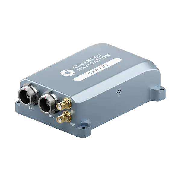
Certus combines temperature calibrated accelerometers, gyroscopes, magnetometers, and a pressure sensor with a dual antenna GNSS receiver. These are coupled in an AI-based fusion algorithm to deliver accurate and reliable navigation data. It features low SWaP-C (Size, Weight, Power, and Cost), internal data logging, and multiple communication interfaces for easy integration. Certus is available in both OEM and rugged packages and comes standard with license-free 1 cm RTK position accuracy.