Tech Article

Published on:
Over the past decade, global defense forces have been grappling with the challenge of electronic warfare, such as GNSS or GPS interference and disruptive espionage. With low-cost jamming and spoofing technologies becoming widely available, defense fleets are urged to seek assured Position, Navigation and Timing (PNT) solutions to ensure the operability of critical assets, such as armored combat vehicles, in GNSS-denied environments. A highly practical and reliable solution is inertial navigation systems (INS). The urgency for integration of this technology is evident, with The White House Office of Science and Technology adding PNT to its 2024 list of Critical and Emerging Technologies. However, many defense forces remain ill-equipped to this day.
INS relies on the principle of dead reckoning, leveraging accelerometers, gyroscopes and sometimes magnetometers to determine an object’s position, orientation and velocity. Unlike GNSS, INS does not rely on satellite signals, which makes it indispensable for armored combat vehicles to remain operational even in the most demanding environments.
In heavily contested regions like Ukraine and the Middle East, defense-grade INS have become crucial for a range of applications.
Serving as both the primary and secondary navigation aids, alongside compass systems and maps, INS provides continuous, real-time navigation data essential for collision avoidance, path planning and situational awareness. Additionally, they can enable armored combat vehicles to operate with enhanced autonomy.
Rapid and precise north-seeking is one of the most crucial capabilities for armored combat vehicles out on the battlefield. Defense-grade INS, such as Advanced Navigation’s Boreas GNSS/INS, are built with highly sensitive gyroscopes capable of detecting the Earth’s rotation and measuring angular velocities of less than 15°/hr. This precision allows for rapid north-seeking, achieving coarse alignment within 2 minutes and fine alignment in just 10. Such speed is essential for maintaining combat and tactical readiness, enabling vehicles to swiftly determine their heading and adapt to different scenarios.
Precise pointing and turret stabilization are also key applications of INS systems in armored combat vehicles, enabling operators to maintain precise pointing capabilities. For these systems, MEMS-based inertial measurement units (IMU) are typically used, such as Advanced Navigation’s Motus. These units, commonly available in OEM form, can be easily integrated into gimbaled rotary platforms. Their precision is especially vital for long-range systems, ensuring both pointing and tracking accuracy.
Historically, INS solutions were only fitted onto specialized vehicles due to their high costs and engineering challenges. In recent years, evolutionary advancements have eliminated their cost and complexity, making them far more accessible. Nevertheless, for defense applications, they still need to meet strict military specifications and requirements to ensure reliability and suitability in demanding environments.
High-precision accelerometers and gyroscopes are essential for ensuring the accuracy and reliability of INS systems. By fusing these sensors with input from other sources, the INS can detect the smallest changes in movement and gather highly accurate navigation data.
Robust military-grade materials and designs are necessary to withstand extreme conditions that armored vehicles may encounter. This includes high vibrations, severe temperature fluctuations and exposure to harsh climates. Reliability in these conditions is vital, as any system failure could jeopardize missions.
Seamless integration and scalability are vital for smooth INS integration into large vehicle fleets. As the INS is easily deployed across a wide range of vehicles, this removes the need for extensive vehicle modifications.
When it comes to INS suppliers, Advanced Navigation has established itself as one of the most innovative and trusted manufacturers. In fact, nine of the largest defense primes rely on Advanced Navigation’s solutions, including Hanwha and Rheinmetall, who develop armored vehicles for Defense Forces.
For their respective vehicle builds, both companies have chosen Advanced Navigation for their primary navigation solution, with Hanwha selecting Boreas D70 and Rheinmetall opting for a strategic-grade FOG INS.
As part of the LAND 400 Phase 3 program, Hanwha Defence Australia (HDA) is contracted to deliver 129 Redback infantry fighting vehicles (IFV) to ensure the Australian Army can respond to formidable land challenges, while providing high-level protection and mobility for soldiers.
According to HDA, the Redback vehicles are advanced fifth-generation IFVs, developed specifically for Australian requirements while utilizing the latest technology.
Boreas D70, Advanced Navigation’s defense-grade INS, offers ultra-precise navigation and heading thanks to its Digital Fiber-Optic Gyroscope (FOG) technology. Featuring a bias stability of 0.001°/hr, position accuracy of 0.01m and a heading accuracy of 0.01°, the system ensures precision navigation in GNSS-denied environments. Its custom-made optical coils and advanced digital technologies enhance precision while reducing size, weight and power requirements (SWaP-C). This makes it one of the best performance-to-value INS solutions available.
Indeed, these attributes were key factors in Hanwha’s decision to secure hundreds of Boreas D70 units for integration into their Redback IFVs.
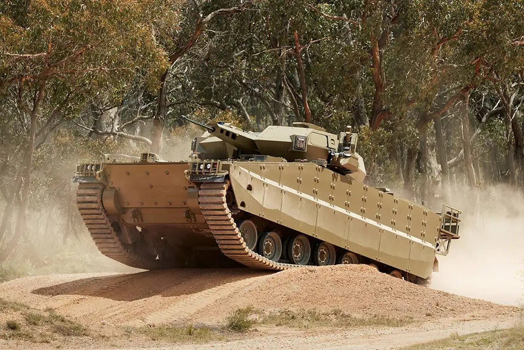
Hanwha Redback infantry fighting vehicle (IFV)
In service with armies around the globe, Rheinmetall’s Boxer CRV offers enhanced troop safety, security and protection, coupled with high levels of firepower and mobility for sustained operations ranging from peacekeeping to high-intensity combat. The Boxer CRV is equipped with a reconnaissance mission module including the two-person digital Lance turret; the first crewed medium-caliber turret to be put into service on the Boxer platform.
The Boxer CRV will be integrated with Advanced Navigation’s strategic-grade FOG INS. Housing Advanced Navigation’s breakthrough algorithmic technology, the FOG INS will deliver navigation data superior to outputs based on traditional filter methods, while hosting a small form factor. Additionally, the built-in optical gyroscope technology has no moving parts. This makes it less susceptible to shock and vibration-induced errors, which is critical when the vehicle is traveling through rough terrains.
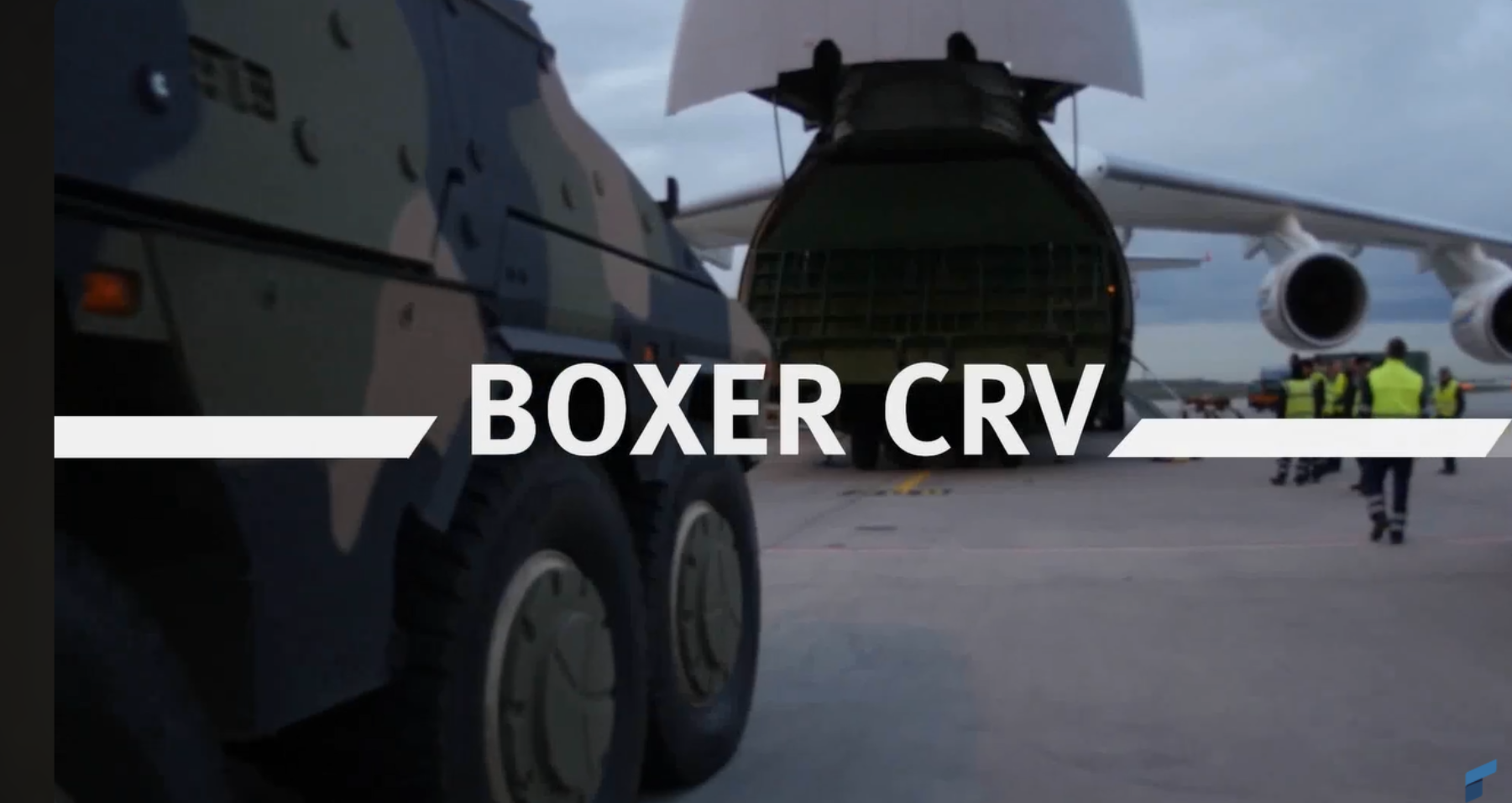
Rheinmetall Boxer CRV
Given the growing demand for reliable, high-performance INS solutions, Advanced Navigation has made significant advancements to this technology over the past decade. While its Boreas DFOG represents some of the best innovations in PNT technology, what truly sets the company’s products apart goes beyond technical specification—it is the unwavering commitment to ease of integration and customer-focused support that make their products stand out.
Ease of integration – Advanced Navigation’s systems are designed to be universally compatible and protocol-agnostic. This makes them relatively simple to integrate into a range of vehicle platforms without requiring modifications.
Rapid production and delivery – All products are developed and delivered on stringent timelines, supported by vertically integrated production facilities. This capability ensures the shortest production lead times in the industry, setting a new standard. Their ITAR-free status also simplifies procurement processes and broadens their global reach, making their systems a preferred choice for many defense primes worldwide.
Vertically integrated manufacturing – Advanced Navigation is among a select few globally with vertically integrated manufacturing capabilities for strategic-grade fiber-optic gyroscopes (FOGs). As an Australian-based manufacturer, Advanced Navigation aligns with Pillar 2 of the trilateral AUKUS agreement, which seeks to enhance the stability, security and manufacturing capacity of critical technologies among the UK, Australia and the USA. This keeps critical technology within allied nations, facilitates supply chain resilience, and reduces reliance on foreign suppliers.
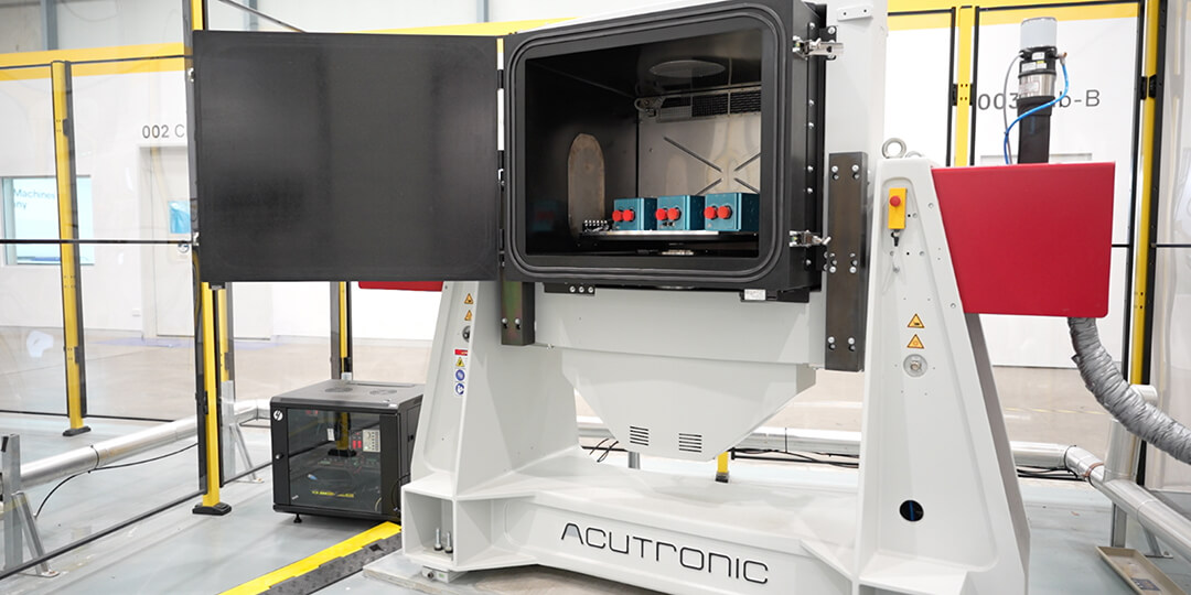
Advanced Navigation products undergo stringent quality control and calibration to meet specifications.
As military operations grow increasingly complex and span multiple frontiers—land, air, sea and space—the need for assured PNT technology, such as INS, is imperative for ensuring mission success.
In response, Advanced Navigation has been developing new sensor technologies and improving filter algorithms to enhance INS precision and reliability, pushing the boundaries of what could be historically achieved. For example, ultra-accurate systems such as the Boreas D90 can now deliver precision navigation data for significantly longer periods without GNSS signals.

Boreas, Digital Fiber Optic Gyroscope Technology
The impact of these systems extends beyond armored combat vehicles. Modern INS are seldom used as standalone devices, and are often integrated with broader multi-source PNT systems and defense capabilities. This means they not only deliver the inertial data needed to navigate battlefields, but as well the capability needed to tackle contemporary warfare.

20 May 2025
Go to Article
30 March 2025
Go to Article