Tech Article
Published on:
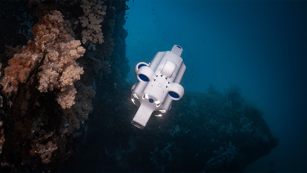
In October 2023, Advanced Navigation deployed its micro hovering autonomous underwater vehicle (AUV) Hydrus off Rottnest Island, Western Australia. The purpose of the mission was to capture high-quality still imagery and 4K video, for the purposes of benthic inspection and 3D photogrammetry reconstruction.
Upon location, the vessel recorded a surface current of over 1.5 knots, with substantial wave action and 18 knots of wind. Hydrus was deployed from the vessel and tracked with Advanced Navigation’s acoustic positioning system, Subsonus. Once underwater, the vehicle descended to an operating depth of around 25m, with an altitude of 1m. The retrieved datasets highlight several notable features of Hydrus including the ability to operate in dynamic currents, navigate complex terrain, and produce incredibly high-resolution data deliverables.
To capture high quality still images, with embedded georeferencing, Hydrus had a mission planned to capture images with 80% forward overlap and 60% lateral overlap. Due to the low altitude and high resolution required, Hydrus flew the mission at a slow speed, shooting video at 4K 30FPS, to reduce motion blur. Once at the mission site, Hydrus was able to run a ‘lawnmower’ pattern as planned.
Classic techniques to capture imagery in seabeds with swirling, dynamic currents can often prove difficult. Here, divers typically struggle to maintain constant positioning and remote operated vehicles (ROVs) can suffer from drag due to their tethers.
In contrast, Hydrus is able to utilize its doppler velocity log (DVL) to track its position over the seabed and use its high level of control authority from the unique seven thruster configuration to maintain constant lines – in spite of swirling, dynamic currents. This is evident in the movement of the kelp in the video below.
Although the terrain of the seabed in this specific spot was complex to navigate, Hydrus was able to meet the challenge and maintain a set altitude of 1m for the duration of the mission. To achieve this feat, Hydrus measures the DVL beams and maneuvers to hold the preset altitude. Similarly, this system doubles as Hydrus’ obstacle avoidance system, i.e., when objects are acoustically detected in its path, Hydrus will move over the top of them to maintain its set altitude.
In the clip below, Hydrus performs data capture in the camera-down orientation over a complex reef system.
Following the successful data capture, Hydrus was recovered to the boat, and the data was downloaded using WiFi. Initial data quality control was then performed to assess image quality and georeferencing.
The final data processing was performed in Agisoft Metashape, where a 3D mesh was reconstructed using Structure from Motion (SfM) photogrammetry.
The reconstructed seabed, with draped imagery, and underlying bathymetric digital elevation model are shown below.
In a different mission with the Australian Institute of Marine Science, Hydrus was tasked to detect an object of interest in challenging turbid waters. To help overcome this, Hydrus was programmed to follow a meticulous search pattern to detect the object, analogous to a lawn mower working through a field of grass. Methodically sweeping through the designated area, Hydrus’ camera successfully identified points of interest and captured stunningly precise imagery of the target objects.

20 May 2025
Go to Article
30 March 2025
Go to Article