Case Study

Published on:
ARRB Systems, Australia
ARRB Systems is an Australian company specializing in the development and deployment of road condition assessment equipment. With over 30 year’s experience, ARRB has developed an international reputation for innovation and developed a suite of surveying vehicles and software used by government and road maintenance and construction agencies across the world. As proof of concept and delivery, the ARRB Hawkeye platform, which is designed to collect road assets and pavement feature data using ARRB intelligent Pavement Assessment Vehicles (iPAVe), has been used extensively and successfully refined for almost 20 years.
At the core of ARRB Systems offerings is the Hawkeye Survey Solution. Hawkeye has been an industry leading product for some time and remains one of the most complete and advanced data collection systems in the industry today. This modular solution enables complete scalability and customized functionality, whilst delivering consistent, synchronized and integrated data outputs. The resulting data allows ARRB Systems clients to better understand the structural and functional conditions of road surface, contour, drainage and camber and establish optimal maintenance strategies.
The ARRB Systems Gipsi-Trac2 forms part of the Hawkeye solution and is crucial to providing an accurate and effective collection of road condition information. The System gives ARRB Systems equipment high levels of control over the sampling and interpretation of the output data. This allows for full synchronization and integration of spatial data into significant other comprehensive data sets, such as road roughness and pavement strength. It also provides road geometry and positional data that can be used for detailed 3D roadway mapping, location of potential sites for hazardous water collection, and can be used to estimate advisory speed limits for corners and various highway travel times.

An ARRB Systems surveying vehicle
The Hawkeye survey solution incorporates a unique “heartbeat” module that provides high accuracy time-stamping of data parameters. All data streams and reference measurements are synchronized through the high-precision heartbeat. The resulting road survey datasets are precisely synchronized with the output and position data to ensure exact road location at the each reference position.
Referring to filling an extremely important aspect of the overall survey data synchronization requirements, Michael Henson, Hardware Design Engineer at ARRB Systems said, “Even with very precise synchronization of the various data streams, positioning this data precisely and absolutely in the real-world requires a very accurate navigation system”. The resulting solution had to be reliable and cost-effective, however, had to provide accuracy increases with MEMS-based GNSS/INS to ensure that the Hawkeye system remains commercially viable into the future. This has meant proving the system repeatedly for reliable position accuracy in highly variable road and terrain conditions.
“As surveys are made along road networks, we have a particular interest in the location, grade, and cross-slope data. The Spatial Dual provides an accurate fusion of its sensor data to fulfill these requirements.”
Michael Henson, Hardware Design Engineer, ARRB Systems
Due to the highly varied nature of road systems in both urban and rural environments and often unreliable GNSS reception, ARRB sought a navigation system with INS capability that they could rely on to retain accuracy and precision for the complex and detailed road survey data that they gathered.
ARRB approached Advanced Navigation to explore possible solutions that would provide position accuracy in GNSS degraded conditions with an acceptable degree of accuracy . The result was to test the Spatial Dual MEMS GNSSS/INS solution (now replaced by Certus Evo). The results led to adoption of the Spatial Dual as the INS of choice for ARRB Systems solutions in the field.
The results are evidenced by Michael Henson:
“Advanced Navigation provided an accurate spatial solution that could be seamlessly integrated into the Hawkeye system. Spatial Dual, a dual antenna GNSS-aided inertial navigation system (INS), was able to provide ARRB Systems with the precise time, reliable navigation, and accurate orientation needed to deliver optimal project outcomes at maximum efficiency.”
Michael Henson
Henson also noted that whilst they had an existing INS which had been previously used extensively, they required improved dead-reckoning. Integrating Spatial Dual into the Gipsi-Trac2 dead-reckoning system allowed ARRB to navigate consistently through challenging environments where GNSS signals are degraded or interrupted entirely. This capability enabled ARRB to bridge previous gaps in navigation solution technology with seamless and accurate navigation data.
Advanced Navigation was able to provide a high-quality solution that could deliver accuracy increases with MEMS-based GNSS/INS and meet required specifications and do so at a competitive price:
“The quality of the data and the value proposition compared with alternatives were key to the decision to go with Advanced Navigation.”
Said Henson
Although the INS product was core to the partnership, ARRB Systems was also impressed with Advanced Navigation’s ongoing technical support throughout the whole process.
“There has been much communication between our teams, both during the initial development period and afterwards.”
Added Henson
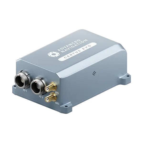
Certus Evo is an AI-based MEMS GNSS-aided INS that provides extremely accurate position, velocity, acceleration and orientation under the most demanding conditions. It offers FOG-like performance combined with the reliability and affordability of MEMS sensors. It features low SWaP-C (Size, Weight, Power, and Cost), internal data logging, and multiple communication interfaces for easy integration. Certus Evo is available in both OEM and rugged packages and comes standard with licence-free 1 cm RTK position accuracy.