Advanced Navigation Demonstrates Technology to Navigate Underground Transport Stations

Published on:
Working with the Office of the NSW Chief Scientist & Engineer, Transport for NSW, Sydney Metro and University of Technology Sydney
July 2025, Australia – Advanced Navigation, a world leader in navigation and autonomous systems, has successfully completed a pilot demonstration of its indoor positioning technology.
The Small Business Innovation & Research Program, which was administered by the Office of the NSW Chief Scientist & Engineer, posed a challenge for companies to develop and trial a hyperlocal navigation technology capable of assisting commuters with vision impairments to navigate the public transport interchanges. The demonstration took place at Castle Hill Station in Sydney, New South Wales (NSW).
“GPS helps people find their way, but it comes with limitations. In underground train stations, for example, its performance significantly drops.“
says Chris Shaw, CEO and co-founder of Advanced Navigation.
“These environments create challenges, particularly for commuters with vision impairments who rely on GPS-aided voice navigation. This pilot program is a powerful example of taking our core navigation technology and creatively applying it to a high-impact, real-world problem. It was rewarding to see its potential to break down barriers and improve accessibility where it’s needed most.“

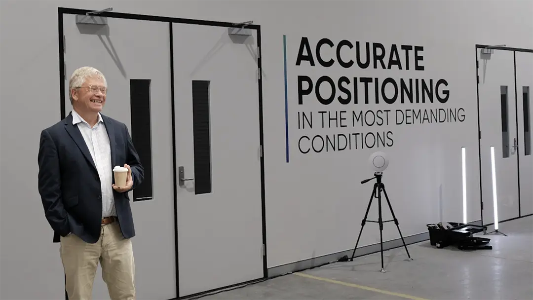
Prior to the pilot, simulations were run across UTS campus sites to refine the system in GPS-denied conditions. NSW Chief Scientist & Engineer, Professor Hugh Durrant-Whyte pictured during testing.
Setting the Stage with Transport
The pilot program involved collaboration efforts from Advanced Navigation, the Office of the NSW Chief Scientist & Engineer, University of Technology Sydney, Transport for NSW and Sydney Metro. Advanced Navigation also consulted with visually impaired individuals to help understand the unique navigation boundaries they face.
The pilot program’s intention was to demonstrate the potential of how uninterrupted, precise navigation can be delivered to commuters navigating underground environments using just their smartphones.
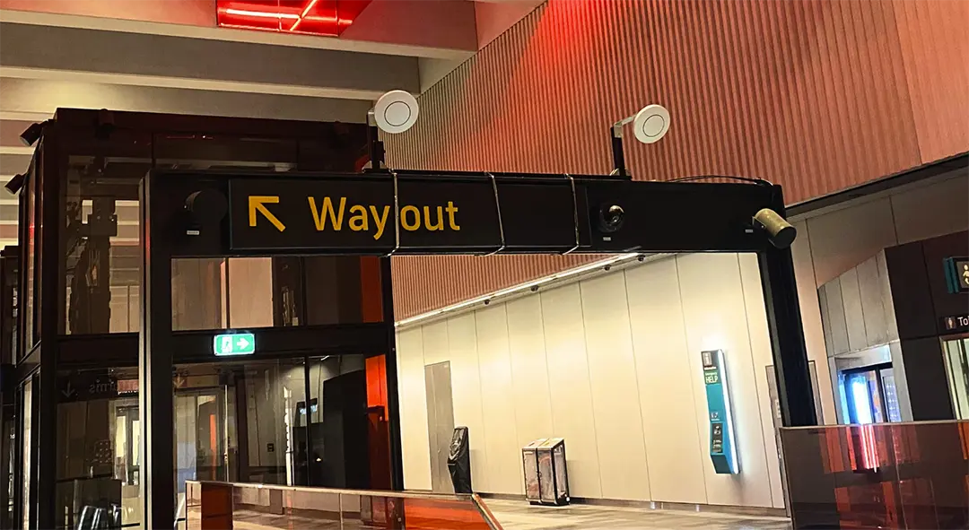
Eleven positioning systems were installed across the station’s concourse and platforms. Using phased array ultra-wideband (UWB) and Bluetooth Low Energy (BLE), the system accurately tracked smartphone locations within 10–30 centimetres, without relying on GPS.

Indoor positioning systems installed across Castle Hill Station
By acting as a seamless replacement for GPS in these blackspot zones, the positioning systems ensure consistent location updates, enabling users to confidently move through complex station features such as escalators, lifts, and platforms, without losing their way.
Demonstrating the Technology with Transport
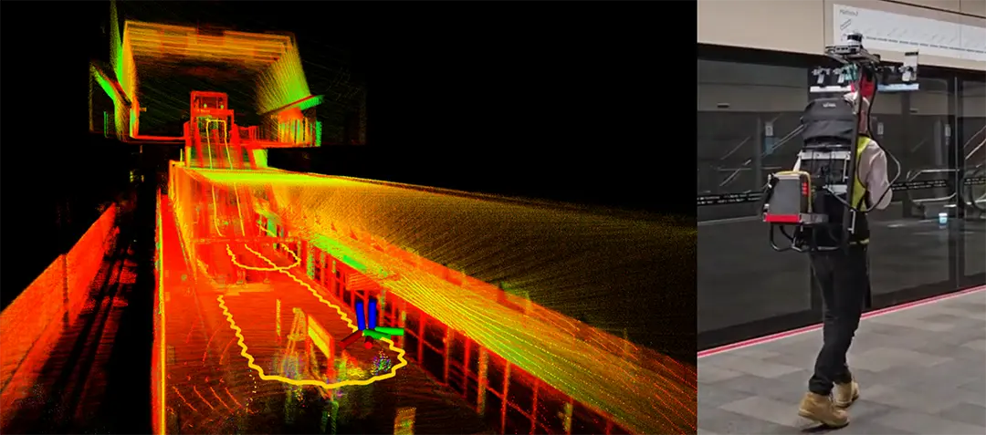
To evaluate performance, the team conducted dual tests using a smartphone and LiDAR scanner mounted on a backpack. While the smartphone captured data from the positioning system, the UTS’ LiDAR system generated a detailed 3D map of the station. By comparing both data sets, the team validated the system’s potential for real-world accuracy and responsiveness.

LiDAR-generated 3D map of Castle Hill Station used to validate the accuracy of the Indoor Positioning Technology.
By replicating commuting conditions under a test environment, the team was able to successfully pinpoint a commuter’s smartphone within 10-30 centimetres from where they were standing, attesting to the technology‘s real-time accuracy and precision.
Research-led, Government-backed Innovation
“Continuous research and development is key to driving innovative solutions to our most challenging problems. Advanced Navigation’s pilot indoor positioning technology offers real promise to improve equity and access to public spaces for the visually impaired community.”
says NSW Chief Scientist & Engineer, Professor Hugh Durrant-Whyte.
Solving Complex Challenges
Advanced Navigation welcomes new opportunities to apply its technologies in environments where GPS is unavailable – from underground tunnels and transit hubs to mines, remote industrial sites, and dense urban areas.
Founded on a culture of research and discovery, Advanced Navigation’s mission is to be the catalyst of the autonomy revolution. Powered by a deep curiosity to apply ground-breaking technologies to uncover and explore new frontiers, the company is ultimately extending human capabilities to build a more resilient and sustainable future, with safer outcomes.
About Advanced Navigation
Advanced Navigation is a global leader in navigation and autonomous systems. By leveraging capabilities in software-enhanced hardware, every solution delivers unrivaled capabilities and exceptional performance across land, air, sea and space applications where GPS is unreliable. Made possible with extensive research, testing and vertically integrated manufacturing, the company has progressed into deep technology fields, including robotics, inertial, photonic and quantum sensing, artificial intelligence, underwater acoustics, and GPS antennas and receivers. Customers choose Advanced Navigation for rapid product delivery and unmatched technical field expertise. Headquartered in Sydney, Australia, with research and production facilities nationwide and offices globally. Advanced Navigation is an Australian manufacturer exporting worldwide. #JoinTheAutonomyRevolution
